Battlefield geodata
Battlefield (Missouri) is a populated place; located in United States in America/Chicago (GMT-5) time zone. With population of 6,001 people, there are 6408 cities with bigger population in this country. Compared to other cities in United States, 65.6% of cities are located further ↑North; 67.2% of cities are located further →East and 83% of cities have lower elevation than Battlefield. Note1
Administrative division(s):
- Level 1: Missouri
- Level 2: Greene County
- Level 3: Township of Battlefield A


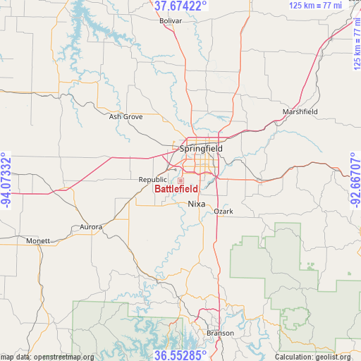
Battlefield GPS coordinates[2]
37° 6' 56.196" North, 93° 22' 12.684" West
| Map corner | latitude | longitude |
|---|---|---|
| Upper-left | 37.67422°, | -94.07332° |
| Center: | 37.11561°, | -93.37019° |
| Lower-right: | 36.55285°, | -92.66707° |
| Map W x H: | 124.7×124.7 km | = 77.5×77.5mi |
| max Lat: | 71.29058° ⇑65.6% North |
| Battlefield: | 37.11561° |
| min Lat: | ⇓34.4% South 19.06759° |
| min Long | Battlefield | max Long |
| -171.73463° | -93.37019° | -66.98998° |
| W 32.8%⇐ | ⇒67.2% E |
Elevation
Elevation of Battlefield is 391 m = 1283 ft, and this is 96.2 m = 316 ft above average elevation for this country.
| Max E: |
3189 m = 10463 ft | 17% |
| Battlefield | 391 m 1283 ft | |
| Avg. | 294.8 m = 967 ft | |
Min E: |
-60 m = -197 ft | 83% |
See also: United States elevation on elevation.city.
Geographical zone
Battlefield is located in North temperate zone (between Tropic of Cancer and the Arctic Circle). Distance of this Northern Tropic circle is 1520.9 km =945 mi to South.| Distance of | km | miles | from Battlefield |
|---|---|---|---|
| North Pole | 5880.2 | 3653.8 | to North |
| Arctic Circle | 3274.3 | 2034.6 | to North |
| Tropic Cancer | 1520.9 | 945 | to South |
| Equator | 4126.9 | 2564.3 | to South |


Nearby cities:
15 places around Battlefield: (largest is in red/bold)
• Ash Grove
29.3 km =18.2 mi,  319°
319°
• Billings
17 km =10.6 mi,  251°
251°
• Clever
13.2 km =8.2 mi,  223°
223°
• Crane
29.4 km =18.3 mi, 217°
• Fremont Hills
12.1 km =7.5 mi,  117°
117°
• Highlandville
21.8 km =13.5 mi,  158°
158°
• Marionville
26.8 km =16.7 mi,  242°
242°
• Nixa
10.5 km =6.5 mi,  140°
140°
• Ozark
18 km =11.2 mi,  125°
125°
• Republic
9.8 km =6.1 mi,  272°
272°
• Rogersville
27.9 km =17.3 mi,  89°
89°
• Sparta
28.6 km =17.8 mi, 116°
• Springfield
12.8 km =8 mi,  29°
29°
• Strafford
28.1 km =17.5 mi,  52°
52°
• Willard
21.7 km =13.5 mi,  346°
346°
Sources, notices
• [Note1] Compared only with cities in United States existing in our database
• [Src1] Map data: © OpenStreetMap contributors (CC-BY-SA)
• [Src2] Other city data from geonames.org with taken over terms of usage.
• [Src3] Geographical zone / Annual Mean Temperature by Robert A. Rohde @ Wikipedia
