Fayetteville geodata
Fayetteville (North Carolina) is a seat of a second-order administrative division; located in United States in America/New_York (GMT-4) time zone. With population of 201,963 people, there are 123 cities with bigger population in this country. Compared to other cities in United States, 75.1% of cities are located further ↑North; 76.1% of cities are located further ←West and 83.6% of cities have higher elevation than Fayetteville. Note1
Administrative division(s):
- Level 1: North Carolina
- Level 2: Cumberland County
- Level 3: Township of Cross Creek


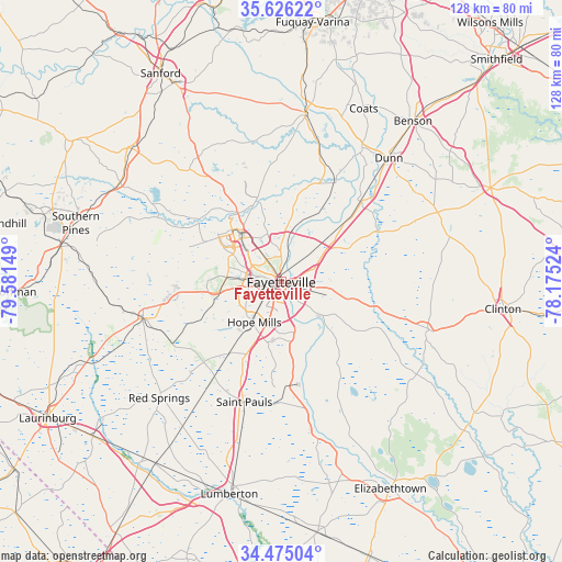
Fayetteville GPS coordinates[2]
35° 3' 9.576" North, 78° 52' 42.096" West
| Map corner | latitude | longitude |
|---|---|---|
| Upper-left | 35.62622°, | -79.58149° |
| Center: | 35.05266°, | -78.87836° |
| Lower-right: | 34.47504°, | -78.17524° |
| Map W x H: | 128×128 km | = 79.5×79.5mi |
| max Lat: | 71.29058° ⇑75.1% North |
| Fayetteville: | 35.05266° |
| min Lat: | ⇓24.9% South 19.06759° |
| min Long | Fayetteville | max Long |
| -171.73463° | -78.87836° | -66.98998° |
| W 76.1%⇐ | ⇒23.9% E |
Elevation
Elevation of Fayetteville is 33 m = 108 ft, and this is 261.8 m = 859 ft below average elevation for this country.
| Max E: |
3189 m = 10463 ft | 83.6% |
| Avg. | 294.8 m = 967 ft | |
| Fayetteville | 33 m = 108 ft | |
Min E: |
-60 m = -197 ft | 16.4% |
See also: Fayetteville elevation on elevation.city.
Geographical zone
Fayetteville is located in North temperate zone (between Tropic of Cancer and the Arctic Circle). Distance of this Northern Tropic circle is 1291.6 km =802.6 mi to South.| Distance of | km | miles | from Fayetteville |
|---|---|---|---|
| North Pole | 6109.6 | 3796.3 | to North |
| Arctic Circle | 3503.7 | 2177.1 | to North |
| Tropic Cancer | 1291.6 | 802.6 | to South |
| Equator | 3897.5 | 2421.8 | to South |


Nearby cities:
15 places around Fayetteville: (largest is in red/bold)
• Bunnlevel
29.9 km =18.6 mi,  17°
17°
• Eastover
8.9 km =5.5 mi,  53°
53°
• Erwin
35.6 km =22.1 mi,  31°
31°
• Fort Bragg
15.1 km =9.4 mi,  309°
309°
• Hope Mills
11 km =6.8 mi,  213°
213°
• Raeford
32.5 km =20.2 mi,  255°
255°
• Rockfish
18.4 km =11.4 mi,  248°
248°
• Roseboro
35.5 km =22.1 mi,  108°
108°
• Saint Pauls
28.6 km =17.8 mi,  197°
197°
• Silver City
32.3 km =20.1 mi, 258°
• Spring Lake
15.4 km =9.6 mi,  326°
326°
• Stedman
17.3 km =10.7 mi,  104°
104°
• Vander
7.9 km =4.9 mi, 106°
• Wade
17.8 km =11.1 mi, 46°
• Walkertown
26.6 km =16.5 mi,  12°
12°
Sources, notices
• [Note1] Compared only with cities in United States existing in our database
• [Src1] Map data: © OpenStreetMap contributors (CC-BY-SA)
• [Src2] Other city data from geonames.org with taken over terms of usage.
• [Src3] Geographical zone / Annual Mean Temperature by Robert A. Rohde @ Wikipedia
