Olustee geodata
Olustee (Oklahoma) is a populated place; located in United States in America/Chicago (GMT-5) time zone. With population of 583 people, there are 19876 cities with bigger population in this country. Compared to other cities in United States, 77.5% of cities are located further ↑North; 80.3% of cities are located further →East and 84.2% of cities have lower elevation than Olustee. Note1


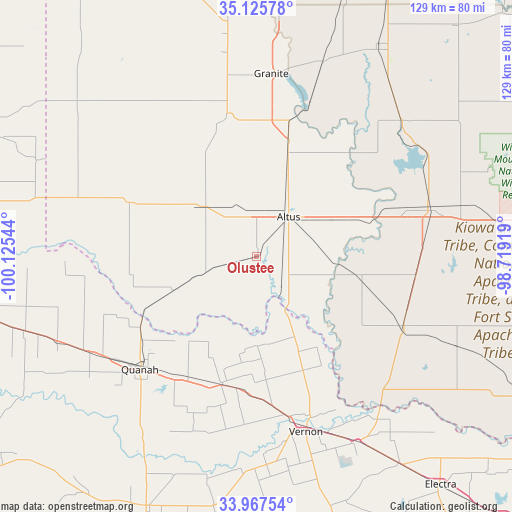
Olustee GPS coordinates[2]
34° 32' 55.248" North, 99° 25' 20.316" West
| Map corner | latitude | longitude |
|---|---|---|
| Upper-left | 35.12578°, | -100.12544° |
| Center: | 34.54868°, | -99.42231° |
| Lower-right: | 33.96754°, | -98.71919° |
| Map W x H: | 128.8×128.8 km | = 80×80mi |
| max Lat: | 71.29058° ⇑77.5% North |
| Olustee: | 34.54868° |
| min Lat: | ⇓22.5% South 19.06759° |
| min Long | Olustee | max Long |
| -171.73463° | -99.42231° | -66.98998° |
| W 19.7%⇐ | ⇒80.3% E |
Elevation
Elevation of Olustee is 409 m = 1342 ft, and this is 114.2 m = 375 ft above average elevation for this country.
| Max E: |
3189 m = 10463 ft | 15.8% |
| Olustee | 409 m 1342 ft | |
| Avg. | 294.8 m = 967 ft | |
Min E: |
-60 m = -197 ft | 84.2% |
See also: United States elevation on elevation.city.
Geographical zone
Olustee is located in North temperate zone (between Tropic of Cancer and the Arctic Circle). Distance of this Northern Tropic circle is 1235.5 km =767.7 mi to South.| Distance of | km | miles | from Olustee |
|---|---|---|---|
| North Pole | 6165.6 | 3831.1 | to North |
| Arctic Circle | 3559.7 | 2211.9 | to North |
| Tropic Cancer | 1235.5 | 767.7 | to South |
| Equator | 3841.5 | 2387 | to South |


Nearby cities:
15 places around Olustee: (largest is in red/bold)
• Altus
12.8 km =8 mi,  39°
39°
• Blair
26.9 km =16.7 mi,  17°
17°
• Childress
72.9 km =45.3 mi,  259°
259°
• Chillicothe
33.6 km =20.9 mi,  194°
194°
• Crowell
68.7 km =42.7 mi,  203°
203°
• Frederick
40.9 km =25.4 mi,  115°
115°
• Granite
46.1 km =28.6 mi,  4°
4°
• Hobart
61.3 km =38.1 mi,  29°
29°
• Hollis
47.4 km =29.5 mi,  289°
289°
• Mangum
36.7 km =22.8 mi,  348°
348°
• Quanah
40.4 km =25.1 mi,  226°
226°
• Sentinel
71.4 km =44.4 mi, 18°
• Snyder
44.8 km =27.8 mi,  74°
74°
• Tipton
26.3 km =16.3 mi,  101°
101°
• Vernon
46 km =28.6 mi,  161°
161°
Sources, notices
• [Note1] Compared only with cities in United States existing in our database
• [Src1] Map data: © OpenStreetMap contributors (CC-BY-SA)
• [Src2] Other city data from geonames.org with taken over terms of usage.
• [Src3] Geographical zone / Annual Mean Temperature by Robert A. Rohde @ Wikipedia
