South Carthage geodata
South Carthage (Tennessee) is a populated place; located in United States in America/Chicago (GMT-5) time zone. With population of 1,334 people, there are 14415 cities with bigger population in this country. Compared to other cities in United States, 69.2% of cities are located further ↑North; 53% of cities are located further ←West and 61.3% of cities have higher elevation than South Carthage. Note1


South Carthage GPS coordinates[2]
36° 14' 31.2" North, 85° 57' 6.948" West
| Map corner | latitude | longitude |
|---|---|---|
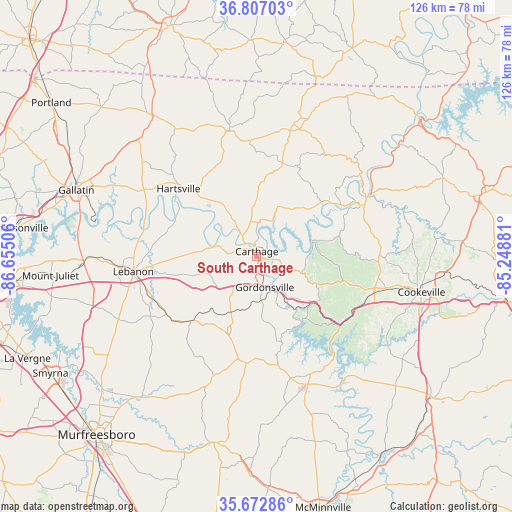
| Upper-left | 36.80703°, | -86.65506° |
| Center: | 36.242°, | -85.95193° |
| Lower-right: | 35.67286°, | -85.24881° |
| Map W x H: | 126.1×126.1 km | = 78.4×78.4mi |
| max Lat: | 71.29058° ⇑69.2% North |
| South Carthage: | 36.242° |
| min Lat: | ⇓30.8% South 19.06759° |
| min Long | South Carthage | max Long |
| -171.73463° | -85.95193° | -66.98998° |
| W 53%⇐ | ⇒47% E |
Elevation
Elevation of South Carthage is 148 m = 486 ft, and this is 146.8 m = 482 ft below average elevation for this country.
| Max E: |
3189 m = 10463 ft | 61.3% |
| Avg. | 294.8 m = 967 ft | |
| South Carthage | 148 m = 486 ft | |
Min E: |
-60 m = -197 ft | 38.7% |
See also: United States elevation on elevation.city.
Geographical zone
South Carthage is located in North temperate zone (between Tropic of Cancer and the Arctic Circle). Distance of this Northern Tropic circle is 1423.8 km =884.7 mi to South.| Distance of | km | miles | from South Carthage |
|---|---|---|---|
| North Pole | 5977.3 | 3714.1 | to North |
| Arctic Circle | 3371.4 | 2094.9 | to North |
| Tropic Cancer | 1423.8 | 884.7 | to South |
| Equator | 4029.7 | 2503.9 | to South |


Nearby cities:
15 places around South Carthage: (largest is in red/bold)
• Alexandria
19.7 km =12.2 mi,  201°
201°
• Baxter
29.4 km =18.3 mi,  109°
109°
• Carthage
1.1 km =0.7 mi,  1°
1°
• Castalian Springs
36.1 km =22.4 mi,  297°
297°
• Cookeville
41.3 km =25.7 mi,  102°
102°
• Dodson Branch
38.4 km =23.9 mi,  78°
78°
• Gainesboro
29.1 km =18.1 mi,  64°
64°
• Gordonsville
8 km =5 mi,  165°
165°
• Hartsville
25.4 km =15.8 mi,  310°
310°
• Lafayette
22.1 km =13.7 mi, 106°
• Lafayette
31.7 km =19.7 mi,  347°
347°
• Lebanon
30.7 km =19.1 mi,  262°
262°
• Red Boiling Springs
33.7 km =20.9 mi,  15°
15°
• Smithville
33.6 km =20.9 mi,  158°
158°
• Watertown
22.6 km =14 mi,  225°
225°
Sources, notices
• [Note1] Compared only with cities in United States existing in our database
• [Src1] Map data: © OpenStreetMap contributors (CC-BY-SA)
• [Src2] Other city data from geonames.org with taken over terms of usage.
• [Src3] Geographical zone / Annual Mean Temperature by Robert A. Rohde @ Wikipedia
