Buckholts geodata
Buckholts (Texas) is a populated place; located in United States in America/Chicago (GMT-5) time zone. With population of 509 people, there are 20770 cities with bigger population in this country. Compared to other cities in United States, 90.9% of cities are located further ↑North; 76.1% of cities are located further →East and 59% of cities have higher elevation than Buckholts. Note1


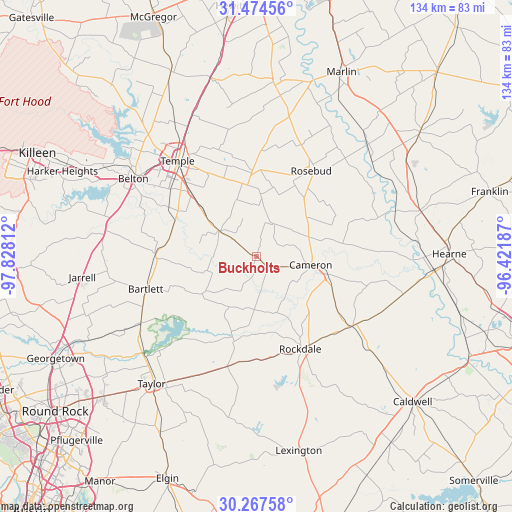
Buckholts GPS coordinates[2]
30° 52' 22.692" North, 97° 7' 29.964" West
| Map corner | latitude | longitude |
|---|---|---|
| Upper-left | 31.47456°, | -97.82812° |
| Center: | 30.87297°, | -97.12499° |
| Lower-right: | 30.26758°, | -96.42187° |
| Map W x H: | 134.2×134.2 km | = 83.4×83.4mi |
| max Lat: | 71.29058° ⇑90.9% North |
| Buckholts: | 30.87297° |
| min Lat: | ⇓9.1% South 19.06759° |
| min Long | Buckholts | max Long |
| -171.73463° | -97.12499° | -66.98998° |
| W 23.9%⇐ | ⇒76.1% E |
Elevation
Elevation of Buckholts is 160 m = 525 ft, and this is 134.8 m = 442 ft below average elevation for this country.
| Max E: |
3189 m = 10463 ft | 59% |
| Avg. | 294.8 m = 967 ft | |
| Buckholts | 160 m = 525 ft | |
Min E: |
-60 m = -197 ft | 41% |
See also: United States elevation on elevation.city.
Geographical zone
Buckholts is located in North temperate zone (between Tropic of Cancer and the Arctic Circle). Distance of this Northern Tropic circle is 826.8 km =513.7 mi to South.| Distance of | km | miles | from Buckholts |
|---|---|---|---|
| North Pole | 6574.3 | 4085.1 | to North |
| Arctic Circle | 3968.4 | 2465.8 | to North |
| Tropic Cancer | 826.8 | 513.7 | to South |
| Equator | 3432.8 | 2133 | to South |


Nearby cities:
15 places around Buckholts: (largest is in red/bold)
• Bartlett
30 km =18.6 mi,  253°
253°
• Belton
38.2 km =23.7 mi,  302°
302°
• Cameron
14.3 km =8.9 mi,  98°
98°
• Granger
34.9 km =21.7 mi,  240°
240°
• Holland
26.4 km =16.4 mi,  271°
271°
• Little River-Academy
25.6 km =15.9 mi, 299°
• Lott
37.7 km =23.4 mi,  12°
12°
• Rockdale
26.9 km =16.7 mi,  153°
153°
• Rogers
11.7 km =7.3 mi, 303°
• Rosebud
26.3 km =16.3 mi,  32°
32°
• Salado
40.3 km =25 mi,  281°
281°
• Sparks
23.2 km =14.4 mi,  285°
285°
• Temple
32.5 km =20.2 mi,  320°
320°
• Thorndale
29.8 km =18.5 mi,  194°
194°
• Thrall
35.4 km =22 mi,  207°
207°
Sources, notices
• [Note1] Compared only with cities in United States existing in our database
• [Src1] Map data: © OpenStreetMap contributors (CC-BY-SA)
• [Src2] Other city data from geonames.org with taken over terms of usage.
• [Src3] Geographical zone / Annual Mean Temperature by Robert A. Rohde @ Wikipedia
