Lindsay geodata
Lindsay (Texas) is a populated place; located in United States in America/Chicago (GMT-5) time zone. With population of 1,078 people, there are 15797 cities with bigger population in this country. Compared to other cities in United States, 82.4% of cities are located further ↑North; 76.4% of cities are located further →East and 61% of cities have lower elevation than Lindsay. Note1


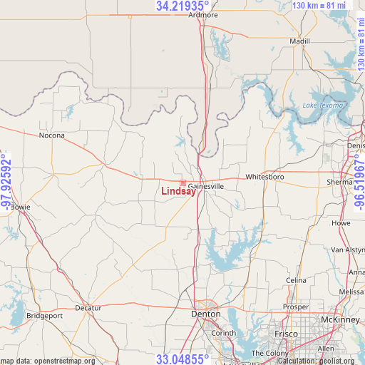
Lindsay GPS coordinates[2]
33° 38' 9.384" North, 97° 13' 22.044" West
| Map corner | latitude | longitude |
|---|---|---|
| Upper-left | 34.21935°, | -97.92592° |
| Center: | 33.63594°, | -97.22279° |
| Lower-right: | 33.04855°, | -96.51967° |
| Map W x H: | 130.2×130.2 km | = 80.9×80.9mi |
| max Lat: | 71.29058° ⇑82.4% North |
| Lindsay: | 33.63594° |
| min Lat: | ⇓17.6% South 19.06759° |
| min Long | Lindsay | max Long |
| -171.73463° | -97.22279° | -66.98998° |
| W 23.6%⇐ | ⇒76.4% E |
Elevation
Elevation of Lindsay is 244 m = 801 ft, and this is 50.8 m = 167 ft below average elevation for this country.
| Max E: |
3189 m = 10463 ft | 39% |
| Avg. | 294.8 m = 967 ft | |
| Lindsay | 244 m = 801 ft | |
Min E: |
-60 m = -197 ft | 61% |
See also: United States elevation on elevation.city.
Geographical zone
Lindsay is located in North temperate zone (between Tropic of Cancer and the Arctic Circle). Distance of this Northern Tropic circle is 1134 km =704.6 mi to South.| Distance of | km | miles | from Lindsay |
|---|---|---|---|
| North Pole | 6267.1 | 3894.2 | to North |
| Arctic Circle | 3661.2 | 2275 | to North |
| Tropic Cancer | 1134 | 704.6 | to South |
| Equator | 3740 | 2323.9 | to South |


Nearby cities:
15 places around Lindsay: (largest is in red/bold)
• Aubrey
42.9 km =26.7 mi,  149°
149°
• Collinsville
30 km =18.6 mi,  105°
105°
• Gainesville
8.4 km =5.2 mi,  97°
97°
• Krum
41.7 km =25.9 mi,  181°
181°
• Lake Kiowa
20.5 km =12.7 mi, 108°
• Marietta
34.9 km =21.7 mi,  16°
16°
• Muenster
14.3 km =8.9 mi,  277°
277°
• Pilot Point
36.1 km =22.4 mi,  137°
137°
• Saint Jo
28.5 km =17.7 mi, 283°
• Sanger
30.7 km =19.1 mi,  171°
171°
• Sherwood Shores
44.5 km =27.7 mi,  57°
57°
• Southmayd
42 km =26.1 mi,  90°
90°
• Tioga
33.9 km =21.1 mi,  123°
123°
• Valley View
17.3 km =10.7 mi,  161°
161°
• Whitesboro
29.3 km =18.2 mi, 85°
Sources, notices
• [Note1] Compared only with cities in United States existing in our database
• [Src1] Map data: © OpenStreetMap contributors (CC-BY-SA)
• [Src2] Other city data from geonames.org with taken over terms of usage.
• [Src3] Geographical zone / Annual Mean Temperature by Robert A. Rohde @ Wikipedia
