Ore City geodata
Ore City (Texas) is a populated place; located in United States in America/Chicago (GMT-5) time zone. With population of 1,189 people, there are 15187 cities with bigger population in this country. Compared to other cities in United States, 85.9% of cities are located further ↑North; 70.4% of cities are located further →East and 69.4% of cities have higher elevation than Ore City. Note1


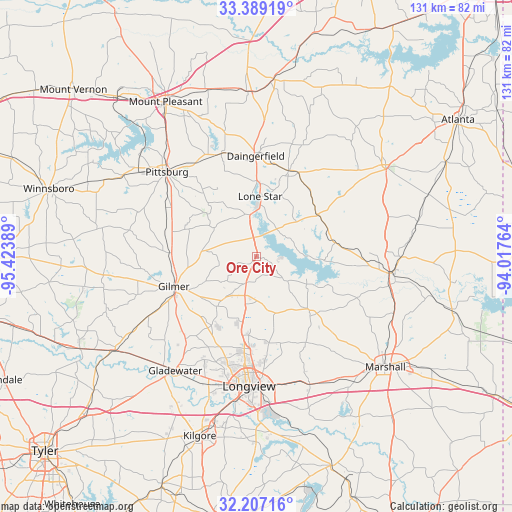
Ore City GPS coordinates[2]
32° 48' 0.504" North, 94° 43' 14.736" West
| Map corner | latitude | longitude |
|---|---|---|
| Upper-left | 33.38919°, | -95.42389° |
| Center: | 32.80014°, | -94.72076° |
| Lower-right: | 32.20716°, | -94.01764° |
| Map W x H: | 131.4×131.4 km | = 81.6×81.6mi |
| max Lat: | 71.29058° ⇑85.9% North |
| Ore City: | 32.80014° |
| min Lat: | ⇓14.1% South 19.06759° |
| min Long | Ore City | max Long |
| -171.73463° | -94.72076° | -66.98998° |
| W 29.6%⇐ | ⇒70.4% E |
Elevation
Elevation of Ore City is 104 m = 341 ft, and this is 190.8 m = 626 ft below average elevation for this country.
| Max E: |
3189 m = 10463 ft | 69.4% |
| Avg. | 294.8 m = 967 ft | |
| Ore City | 104 m = 341 ft | |
Min E: |
-60 m = -197 ft | 30.6% |
See also: United States elevation on elevation.city.
Geographical zone
Ore City is located in North temperate zone (between Tropic of Cancer and the Arctic Circle). Distance of this Northern Tropic circle is 1041.1 km =646.9 mi to South.| Distance of | km | miles | from Ore City |
|---|---|---|---|
| North Pole | 6360 | 3951.9 | to North |
| Arctic Circle | 3754.1 | 2332.7 | to North |
| Tropic Cancer | 1041.1 | 646.9 | to South |
| Equator | 3647 | 2266.1 | to South |


Nearby cities:
15 places around Ore City: (largest is in red/bold)
• Clarksville City
34.6 km =21.5 mi,  209°
209°
• Daingerfield
25.8 km =16 mi,  359°
359°
• East Mountain
26.2 km =16.3 mi, 208°
• Gilmer
22.2 km =13.8 mi,  249°
249°
• Gladewater
35.9 km =22.3 mi,  215°
215°
• Hallsville
35.6 km =22.1 mi,  157°
157°
• Hughes Springs
23.6 km =14.7 mi,  20°
20°
• Jefferson
35.4 km =22 mi,  97°
97°
• Lakeport
43.5 km =27 mi,  178°
178°
• Linden
40.7 km =25.3 mi,  54°
54°
• Lone Star
16 km =9.9 mi,  4°
4°
• Longview
33.3 km =20.7 mi, 183°
• Omaha
42.4 km =26.3 mi, 357°
• Pittsburg
31.5 km =19.6 mi,  313°
313°
• White Oak
33 km =20.5 mi,  203°
203°
Sources, notices
• [Note1] Compared only with cities in United States existing in our database
• [Src1] Map data: © OpenStreetMap contributors (CC-BY-SA)
• [Src2] Other city data from geonames.org with taken over terms of usage.
• [Src3] Geographical zone / Annual Mean Temperature by Robert A. Rohde @ Wikipedia
