Audubon geodata
Audubon (Minnesota) is a populated place; located in United States in America/Chicago (GMT-5) time zone. With population of 510 people, there are 20757 cities with bigger population in this country. Compared to other cities in United States, 96.4% of cities are located further ↓South; 73.4% of cities are located further →East and 83.6% of cities have lower elevation than Audubon. Note1


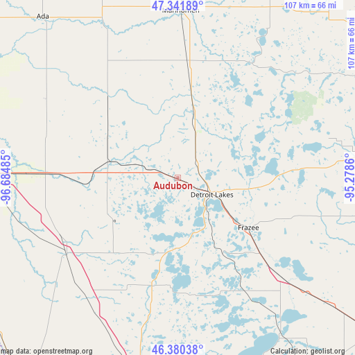
Audubon GPS coordinates[2]
46° 51' 47.844" North, 95° 58' 54.192" West
| Map corner | latitude | longitude |
|---|---|---|
| Upper-left | 47.34189°, | -96.68485° |
| Center: | 46.86329°, | -95.98172° |
| Lower-right: | 46.38038°, | -95.2786° |
| Map W x H: | 106.9×106.9 km | = 66.4×66.4mi |
| max Lat: | 71.29058° ⇑3.6% North |
| Audubon: | 46.86329° |
| min Lat: | ⇓96.4% South 19.06759° |
| min Long | Audubon | max Long |
| -171.73463° | -95.98172° | -66.98998° |
| W 26.6%⇐ | ⇒73.4% E |
Elevation
Elevation of Audubon is 398 m = 1306 ft, and this is 103.2 m = 339 ft above average elevation for this country.
| Max E: |
3189 m = 10463 ft | 16.4% |
| Audubon | 398 m 1306 ft | |
| Avg. | 294.8 m = 967 ft | |
Min E: |
-60 m = -197 ft | 83.6% |
See also: United States elevation on elevation.city.
Geographical zone
Audubon is located in North temperate zone (between Tropic of Cancer and the Arctic Circle). Distance of this North polar circle is 2190.5 km =1361.1 mi to North.| Distance of | km | miles | from Audubon |
|---|---|---|---|
| North Pole | 4796.4 | 2980.3 | to North |
| Arctic Circle | 2190.5 | 1361.1 | to North |
| Tropic Cancer | 2604.8 | 1618.5 | to South |
| Equator | 5210.7 | 3237.8 | to South |


Nearby cities:
15 places around Audubon: (largest is in red/bold)
• Barnesville
40.8 km =25.4 mi,  234°
234°
• Detroit Lakes
11.6 km =7.2 mi,  116°
116°
• Dilworth
54.9 km =34.1 mi,  271°
271°
• Frazee
26.1 km =16.2 mi,  125°
125°
• Glyndon
45.4 km =28.2 mi, 271°
• Hawley
25.5 km =15.8 mi, 274°
• Lake Park
8.9 km =5.5 mi,  286°
286°
• Mahnomen
50.3 km =31.3 mi,  1°
1°
• Naytahwaush
51.9 km =32.2 mi,  31°
31°
• Pelican Rapids
33.4 km =20.8 mi,  193°
193°
• Perham
43.2 km =26.8 mi, 133°
• Sabin
51.9 km =32.2 mi,  259°
259°
• Twin Valley
48.9 km =30.4 mi,  334°
334°
• Ulen
31.9 km =19.8 mi,  318°
318°
• White Earth
28 km =17.4 mi,  22°
22°
Sources, notices
• [Note1] Compared only with cities in United States existing in our database
• [Src1] Map data: © OpenStreetMap contributors (CC-BY-SA)
• [Src2] Other city data from geonames.org with taken over terms of usage.
• [Src3] Geographical zone / Annual Mean Temperature by Robert A. Rohde @ Wikipedia
