Keewatin geodata
Keewatin (Minnesota) is a populated place; located in United States in America/Chicago (GMT-5) time zone. With population of 1,049 people, there are 15968 cities with bigger population in this country. Compared to other cities in United States, 97.4% of cities are located further ↓South; 66.4% of cities are located further →East and 86% of cities have lower elevation than Keewatin. Note1


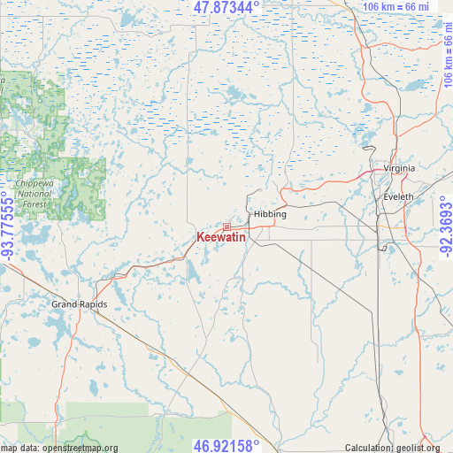
Keewatin GPS coordinates[2]
47° 23' 58.776" North, 93° 4' 20.712" West
| Map corner | latitude | longitude |
|---|---|---|
| Upper-left | 47.87344°, | -93.77555° |
| Center: | 47.39966°, | -93.07242° |
| Lower-right: | 46.92158°, | -92.3693° |
| Map W x H: | 105.8×105.8 km | = 65.7×65.7mi |
| max Lat: | 71.29058° ⇑2.6% North |
| Keewatin: | 47.39966° |
| min Lat: | ⇓97.4% South 19.06759° |
| min Long | Keewatin | max Long |
| -171.73463° | -93.07242° | -66.98998° |
| W 33.6%⇐ | ⇒66.4% E |
Elevation
Elevation of Keewatin is 444 m = 1457 ft, and this is 149.2 m = 490 ft above average elevation for this country.
| Max E: |
3189 m = 10463 ft | 14% |
| Keewatin | 444 m 1457 ft | |
| Avg. | 294.8 m = 967 ft | |
Min E: |
-60 m = -197 ft | 86% |
See also: United States elevation on elevation.city.
Geographical zone
Keewatin is located in North temperate zone (between Tropic of Cancer and the Arctic Circle). Distance of this North polar circle is 2130.8 km =1324 mi to North.| Distance of | km | miles | from Keewatin |
|---|---|---|---|
| North Pole | 4736.7 | 2943.2 | to North |
| Arctic Circle | 2130.8 | 1324 | to North |
| Tropic Cancer | 2664.4 | 1655.6 | to South |
| Equator | 5270.3 | 3274.8 | to South |


Nearby cities:
15 places around Keewatin: (largest is in red/bold)
• Bovey
28.6 km =17.8 mi,  246°
246°
• Buhl
24.5 km =15.2 mi,  64°
64°
• Chisholm
17.3 km =10.7 mi,  54°
54°
• Cohasset
44 km =27.3 mi, 249°
• Coleraine
29.5 km =18.3 mi, 245°
• Eveleth
40.7 km =25.3 mi,  80°
80°
• Grand Rapids
39 km =24.2 mi,  242°
242°
• Hibbing
10.6 km =6.6 mi,  73°
73°
• La Prairie
36.7 km =22.8 mi, 238°
• Marble
19.2 km =11.9 mi, 242°
• Mountain Iron
36.8 km =22.9 mi, 66°
• Nashwauk
7.5 km =4.7 mi, 253°
• Parkville
39.9 km =24.8 mi, 68°
• Taconite
25.3 km =15.7 mi, 247°
• Virginia
42.6 km =26.5 mi, 71°
Sources, notices
• [Note1] Compared only with cities in United States existing in our database
• [Src1] Map data: © OpenStreetMap contributors (CC-BY-SA)
• [Src2] Other city data from geonames.org with taken over terms of usage.
• [Src3] Geographical zone / Annual Mean Temperature by Robert A. Rohde @ Wikipedia
