Littlefork geodata
Littlefork (Minnesota) is a populated place; located in United States in America/Chicago (GMT-5) time zone. With population of 622 people, there are 19448 cities with bigger population in this country. Compared to other cities in United States, 99.1% of cities are located further ↓South; 67.6% of cities are located further →East and 78.7% of cities have lower elevation than Littlefork. Note1
Administrative division(s):
- Level 1: Minnesota
- Level 2: Koochiching County
- Level 3: City of Littlefork


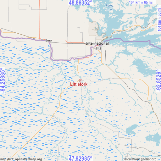
Littlefork GPS coordinates[2]
48° 23' 55.788" North, 93° 33' 20.592" West
| Map corner | latitude | longitude |
|---|---|---|
| Upper-left | 48.86352°, | -94.25885° |
| Center: | 48.39883°, | -93.55572° |
| Lower-right: | 47.92985°, | -92.8526° |
| Map W x H: | 103.8×103.8 km | = 64.5×64.5mi |
| max Lat: | 71.29058° ⇑0.9% North |
| Littlefork: | 48.39883° |
| min Lat: | ⇓99.1% South 19.06759° |
| min Long | Littlefork | max Long |
| -171.73463° | -93.55572° | -66.98998° |
| W 32.4%⇐ | ⇒67.6% E |
Elevation
Elevation of Littlefork is 342 m = 1122 ft, and this is 47.2 m = 155 ft above average elevation for this country.
| Max E: |
3189 m = 10463 ft | 21.3% |
| Littlefork | 342 m 1122 ft | |
| Avg. | 294.8 m = 967 ft | |
Min E: |
-60 m = -197 ft | 78.7% |
See also: United States elevation on elevation.city.
Geographical zone
Littlefork is located in North temperate zone (between Tropic of Cancer and the Arctic Circle). Distance of this North polar circle is 2019.7 km =1255 mi to North.| Distance of | km | miles | from Littlefork |
|---|---|---|---|
| North Pole | 4625.6 | 2874.2 | to North |
| Arctic Circle | 2019.7 | 1255 | to North |
| Tropic Cancer | 2775.5 | 1724.6 | to South |
| Equator | 5381.4 | 3343.8 | to South |


Nearby cities:
15 places around Littlefork: (largest is in red/bold)
• Baudette
84.4 km =52.4 mi,  294°
294°
• Blackduck
104.5 km =64.9 mi,  224°
224°
• Buhl
116.1 km =72.1 mi,  150°
150°
• Chisholm
112.9 km =70.2 mi, 153°
• Cook
88.4 km =54.9 mi,  133°
133°
• Deer River
119.8 km =74.4 mi,  188°
188°
• Hibbing
117.4 km =72.9 mi,  156°
156°
• International Falls
24.9 km =15.5 mi,  25°
25°
• Keewatin
116.8 km =72.6 mi, 162°
• Mountain Iron
118.7 km =73.8 mi,  144°
144°
• Nashwauk
116.9 km =72.6 mi,  165°
165°
• Parkville
120.8 km =75.1 mi, 142°
• Ponemah
109.1 km =67.8 mi,  247°
247°
• Ranier
28.3 km =17.6 mi, 32°
• Redby
116.1 km =72.1 mi,  240°
240°
Sources, notices
• [Note1] Compared only with cities in United States existing in our database
• [Src1] Map data: © OpenStreetMap contributors (CC-BY-SA)
• [Src2] Other city data from geonames.org with taken over terms of usage.
• [Src3] Geographical zone / Annual Mean Temperature by Robert A. Rohde @ Wikipedia
