Hankinson geodata
Hankinson (North Dakota) is a populated place; located in United States in America/Chicago (GMT-5) time zone. With population of 908 people, there are 16935 cities with bigger population in this country. Compared to other cities in United States, 95.1% of cities are located further ↓South; 75.4% of cities are located further →East and 76.8% of cities have lower elevation than Hankinson. Note1
Administrative division(s):
- Level 1: North Dakota
- Level 2: Richland County
- Level 3: City of Hankinson


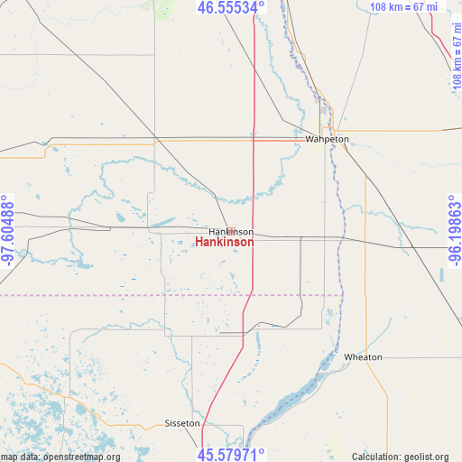
Hankinson GPS coordinates[2]
46° 4' 10.848" North, 96° 54' 6.3" West
| Map corner | latitude | longitude |
|---|---|---|
| Upper-left | 46.55534°, | -97.60488° |
| Center: | 46.06968°, | -96.90175° |
| Lower-right: | 45.57971°, | -96.19863° |
| Map W x H: | 108.5×108.5 km | = 67.4×67.4mi |
| max Lat: | 71.29058° ⇑4.9% North |
| Hankinson: | 46.06968° |
| min Lat: | ⇓95.1% South 19.06759° |
| min Long | Hankinson | max Long |
| -171.73463° | -96.90175° | -66.98998° |
| W 24.6%⇐ | ⇒75.4% E |
Elevation
Elevation of Hankinson is 326 m = 1070 ft, and this is 31.2 m = 102 ft above average elevation for this country.
| Max E: |
3189 m = 10463 ft | 23.2% |
| Hankinson | 326 m 1070 ft | |
| Avg. | 294.8 m = 967 ft | |
Min E: |
-60 m = -197 ft | 76.8% |
See also: United States elevation on elevation.city.
Geographical zone
Hankinson is located in North temperate zone (between Tropic of Cancer and the Arctic Circle). Distance of this North polar circle is 2278.7 km =1415.9 mi to North.| Distance of | km | miles | from Hankinson |
|---|---|---|---|
| North Pole | 4884.6 | 3035.1 | to North |
| Arctic Circle | 2278.7 | 1415.9 | to North |
| Tropic Cancer | 2516.5 | 1563.7 | to South |
| Equator | 5122.5 | 3183 | to South |


Nearby cities:
15 places around Hankinson: (largest is in red/bold)
• Breckenridge
32.4 km =20.1 mi,  48°
48°
• Browns Valley
53 km =32.9 mi,  174°
174°
• Elbow Lake
71.9 km =44.7 mi,  96°
96°
• Fergus Falls
67.7 km =42.1 mi,  69°
69°
• Forman
56.8 km =35.3 mi,  274°
274°
• Goodwill
57.4 km =35.7 mi,  193°
193°
• Graceville
66.4 km =41.3 mi,  146°
146°
• Gwinner
61.1 km =38 mi,  286°
286°
• Kindred
65 km =40.4 mi,  352°
352°
• Lidgerwood
19.3 km =12 mi, 271°
• Milnor
47.6 km =29.6 mi,  296°
296°
• Sisseton
46.5 km =28.9 mi, 194°
• Veblen
37.6 km =23.4 mi,  232°
232°
• Wahpeton
31.5 km =19.6 mi, 46°
• Wheaton
42.9 km =26.7 mi,  133°
133°
Sources, notices
• [Note1] Compared only with cities in United States existing in our database
• [Src1] Map data: © OpenStreetMap contributors (CC-BY-SA)
• [Src2] Other city data from geonames.org with taken over terms of usage.
• [Src3] Geographical zone / Annual Mean Temperature by Robert A. Rohde @ Wikipedia
