Fergus Falls geodata
Fergus Falls (Minnesota) is a seat of a second-order administrative division; located in United States in America/Chicago (GMT-5) time zone. With population of 13,281 people, there are 3603 cities with bigger population in this country. Compared to other cities in United States, 95.5% of cities are located further ↓South; 73.6% of cities are located further →East and 80.7% of cities have lower elevation than Fergus Falls. Note1
Administrative division(s):
- Level 1: Minnesota
- Level 2: Otter Tail County
- Level 3: City of Fergus Falls


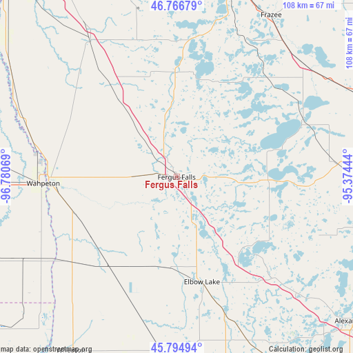
Fergus Falls GPS coordinates[2]
46° 16' 58.872" North, 96° 4' 39.216" West
| Map corner | latitude | longitude |
|---|---|---|
| Upper-left | 46.76679°, | -96.78069° |
| Center: | 46.28302°, | -96.07756° |
| Lower-right: | 45.79494°, | -95.37444° |
| Map W x H: | 108.1×108.1 km | = 67.2×67.2mi |
| max Lat: | 71.29058° ⇑4.5% North |
| Fergus Falls: | 46.28302° |
| min Lat: | ⇓95.5% South 19.06759° |
| min Long | Fergus Falls | max Long |
| -171.73463° | -96.07756° | -66.98998° |
| W 26.4%⇐ | ⇒73.6% E |
Elevation
Elevation of Fergus Falls is 361 m = 1184 ft, and this is 66.2 m = 217 ft above average elevation for this country.
| Max E: |
3189 m = 10463 ft | 19.3% |
| Fergus Falls | 361 m 1184 ft | |
| Avg. | 294.8 m = 967 ft | |
Min E: |
-60 m = -197 ft | 80.7% |
See also: United States elevation on elevation.city.
Geographical zone
Fergus Falls is located in North temperate zone (between Tropic of Cancer and the Arctic Circle). Distance of this North polar circle is 2255 km =1401.2 mi to North.| Distance of | km | miles | from Fergus Falls |
|---|---|---|---|
| North Pole | 4860.9 | 3020.4 | to North |
| Arctic Circle | 2255 | 1401.2 | to North |
| Tropic Cancer | 2540.3 | 1578.5 | to South |
| Equator | 5146.2 | 3197.7 | to South |


Nearby cities:
15 places around Fergus Falls: (largest is in red/bold)
• Barnesville
48.7 km =30.3 mi,  327°
327°
• Battle Lake
28 km =17.4 mi,  90°
90°
• Breckenridge
39.3 km =24.4 mi,  266°
266°
• Detroit Lakes
62 km =38.5 mi,  16°
16°
• Elbow Lake
33 km =20.5 mi,  166°
166°
• Evansville
43.4 km =27 mi,  135°
135°
• Frazee
57.3 km =35.6 mi,  30°
30°
• Henning
48.8 km =30.3 mi,  84°
84°
• Hoffman
55 km =34.2 mi,  156°
156°
• New York Mills
59.8 km =37.2 mi,  64°
64°
• Ottertail
43 km =26.7 mi,  68°
68°
• Parkers Prairie
59.4 km =36.9 mi,  104°
104°
• Pelican Rapids
32 km =19.9 mi,  359°
359°
• Perham
51.9 km =32.2 mi,  48°
48°
• Wahpeton
40.7 km =25.3 mi, 267°
Sources, notices
• [Note1] Compared only with cities in United States existing in our database
• [Src1] Map data: © OpenStreetMap contributors (CC-BY-SA)
• [Src2] Other city data from geonames.org with taken over terms of usage.
• [Src3] Geographical zone / Annual Mean Temperature by Robert A. Rohde @ Wikipedia
