Menomonie geodata
Menomonie (Wisconsin) is a populated place; located in United States in America/Chicago (GMT-5) time zone. With population of 16,305 people, there are 3014 cities with bigger population in this country. Compared to other cities in United States, 91.9% of cities are located further ↓South; 63.9% of cities are located further →East and 66.6% of cities have lower elevation than Menomonie. Note1


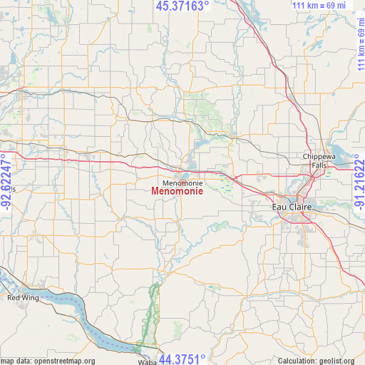
Menomonie GPS coordinates[2]
44° 52' 31.872" North, 91° 55' 9.624" West
| Map corner | latitude | longitude |
|---|---|---|
| Upper-left | 45.37163°, | -92.62247° |
| Center: | 44.87552°, | -91.91934° |
| Lower-right: | 44.3751°, | -91.21622° |
| Map W x H: | 110.8×110.8 km | = 68.8×68.8mi |
| max Lat: | 71.29058° ⇑8.1% North |
| Menomonie: | 44.87552° |
| min Lat: | ⇓91.9% South 19.06759° |
| min Long | Menomonie | max Long |
| -171.73463° | -91.91934° | -66.98998° |
| W 36.1%⇐ | ⇒63.9% E |
Elevation
Elevation of Menomonie is 269 m = 883 ft, and this is 25.8 m = 85 ft below average elevation for this country.
| Max E: |
3189 m = 10463 ft | 33.4% |
| Avg. | 294.8 m = 967 ft | |
| Menomonie | 269 m = 883 ft | |
Min E: |
-60 m = -197 ft | 66.6% |
See also: United States elevation on elevation.city.
Geographical zone
Menomonie is located in North temperate zone (between Tropic of Cancer and the Arctic Circle). Distance of this Northern Tropic circle is 2383.8 km =1481.2 mi to South.| Distance of | km | miles | from Menomonie |
|---|---|---|---|
| North Pole | 5017.4 | 3117.7 | to North |
| Arctic Circle | 2411.5 | 1498.4 | to North |
| Tropic Cancer | 2383.8 | 1481.2 | to South |
| Equator | 4989.7 | 3100.5 | to South |


Nearby cities:
15 places around Menomonie: (largest is in red/bold)
• Altoona
38.4 km =23.9 mi,  101°
101°
• Baldwin
37.2 km =23.1 mi,  285°
285°
• Boyceville
21 km =13 mi,  332°
332°
• Colfax
20.3 km =12.6 mi,  48°
48°
• Durand
27.9 km =17.3 mi,  187°
187°
• Eau Claire
33.9 km =21.1 mi, 102°
• El Paso
35.5 km =22.1 mi,  250°
250°
• Elk Mound
18 km =11.2 mi,  90°
90°
• Elmwood
20.7 km =12.9 mi,  239°
239°
• Glenwood City
28.5 km =17.7 mi,  315°
315°
• Lake Hallie
37.7 km =23.4 mi, 89°
• Plum City
34.9 km =21.7 mi,  218°
218°
• Spring Valley
25.4 km =15.8 mi,  262°
262°
• Tainter Lake
13.8 km =8.6 mi,  24°
24°
• Woodville
30.5 km =19 mi, 286°
Sources, notices
• [Note1] Compared only with cities in United States existing in our database
• [Src1] Map data: © OpenStreetMap contributors (CC-BY-SA)
• [Src2] Other city data from geonames.org with taken over terms of usage.
• [Src3] Geographical zone / Annual Mean Temperature by Robert A. Rohde @ Wikipedia
