Spring Valley geodata
Spring Valley (Wisconsin) is a populated place; located in United States in America/Chicago (GMT-5) time zone. With population of 1,342 people, there are 14382 cities with bigger population in this country. Compared to other cities in United States, 91.8% of cities are located further ↓South; 64.7% of cities are located further →East and 68.9% of cities have lower elevation than Spring Valley. Note1
Administrative division(s):
- Level 1: Wisconsin
- Level 2: Pierce County
- Level 3: Village of Spring Valley


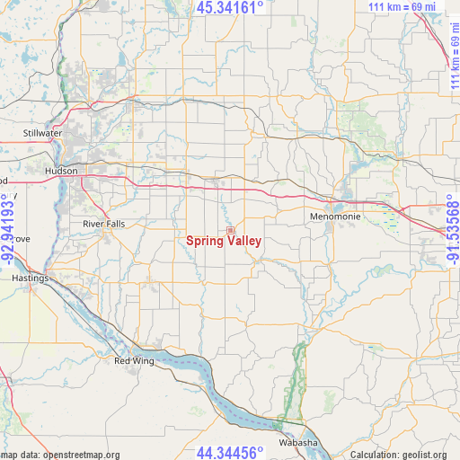
Spring Valley GPS coordinates[2]
44° 50' 42.864" North, 92° 14' 19.68" West
| Map corner | latitude | longitude |
|---|---|---|
| Upper-left | 45.34161°, | -92.94193° |
| Center: | 44.84524°, | -92.2388° |
| Lower-right: | 44.34456°, | -91.53568° |
| Map W x H: | 110.9×110.9 km | = 68.9×68.9mi |
| max Lat: | 71.29058° ⇑8.2% North |
| Spring Valley: | 44.84524° |
| min Lat: | ⇓91.8% South 19.06759° |
| min Long | Spring Valley | max Long |
| -171.73463° | -92.2388° | -66.98998° |
| W 35.3%⇐ | ⇒64.7% E |
Elevation
Elevation of Spring Valley is 280 m = 919 ft, and this is 14.8 m = 49 ft below average elevation for this country.
| Max E: |
3189 m = 10463 ft | 31.1% |
| Avg. | 294.8 m = 967 ft | |
| Spring Valley | 280 m = 919 ft | |
Min E: |
-60 m = -197 ft | 68.9% |
See also: United States elevation on elevation.city.
Geographical zone
Spring Valley is located in North temperate zone (between Tropic of Cancer and the Arctic Circle). Distance of this Northern Tropic circle is 2380.4 km =1479.1 mi to South.| Distance of | km | miles | from Spring Valley |
|---|---|---|---|
| North Pole | 5020.7 | 3119.7 | to North |
| Arctic Circle | 2414.9 | 1500.5 | to North |
| Tropic Cancer | 2380.4 | 1479.1 | to South |
| Equator | 4986.3 | 3098.3 | to South |


Nearby cities:
15 places around Spring Valley: (largest is in red/bold)
• Baldwin
17.2 km =10.7 mi,  321°
321°
• Boyceville
27 km =16.8 mi,  35°
35°
• Durand
32.5 km =20.2 mi,  138°
138°
• El Paso
11.8 km =7.3 mi,  224°
224°
• Ellsworth
23.3 km =14.5 mi,  237°
237°
• Elmwood
10.2 km =6.3 mi,  134°
134°
• Glenwood City
24.3 km =15.1 mi,  12°
12°
• Hammond
21.5 km =13.4 mi,  313°
313°
• Menomonie
25.4 km =15.8 mi,  82°
82°
• New Richmond
38.8 km =24.1 mi, 322°
• Plum City
24.3 km =15.1 mi,  171°
171°
• River Falls
30.4 km =18.9 mi,  273°
273°
• Roberts
29.4 km =18.3 mi,  301°
301°
• Tainter Lake
34.7 km =21.6 mi,  62°
62°
• Woodville
12.7 km =7.9 mi,  340°
340°
Sources, notices
• [Note1] Compared only with cities in United States existing in our database
• [Src1] Map data: © OpenStreetMap contributors (CC-BY-SA)
• [Src2] Other city data from geonames.org with taken over terms of usage.
• [Src3] Geographical zone / Annual Mean Temperature by Robert A. Rohde @ Wikipedia
