Guadalupe geodata
Guadalupe (Arizona) is a populated place; located in United States in America/Phoenix (GMT-7) time zone. With population of 6,177 people, there are 6283 cities with bigger population in this country. Compared to other cities in United States, 83.7% of cities are located further ↑North; 87.4% of cities are located further →East and 82% of cities have lower elevation than Guadalupe. Note1


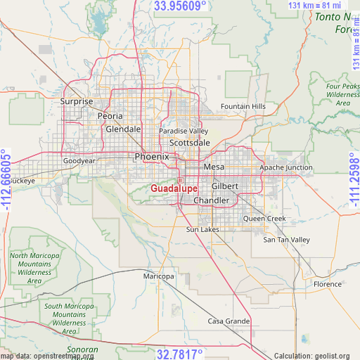
Guadalupe GPS coordinates[2]
33° 22' 15.168" North, 111° 57' 46.512" West
| Map corner | latitude | longitude |
|---|---|---|
| Upper-left | 33.95609°, | -112.66605° |
| Center: | 33.37088°, | -111.96292° |
| Lower-right: | 32.7817°, | -111.2598° |
| Map W x H: | 130.6×130.6 km | = 81.2×81.2mi |
| max Lat: | 71.29058° ⇑83.7% North |
| Guadalupe: | 33.37088° |
| min Lat: | ⇓16.3% South 19.06759° |
| min Long | Guadalupe | max Long |
| -171.73463° | -111.96292° | -66.98998° |
| W 12.6%⇐ | ⇒87.4% E |
Elevation
Elevation of Guadalupe is 376 m = 1234 ft, and this is 81.2 m = 266 ft above average elevation for this country.
| Max E: |
3189 m = 10463 ft | 18% |
| Guadalupe | 376 m 1234 ft | |
| Avg. | 294.8 m = 967 ft | |
Min E: |
-60 m = -197 ft | 82% |
See also: United States elevation on elevation.city.
Geographical zone
Guadalupe is located in North temperate zone (between Tropic of Cancer and the Arctic Circle). Distance of this Northern Tropic circle is 1104.6 km =686.4 mi to South.| Distance of | km | miles | from Guadalupe |
|---|---|---|---|
| North Pole | 6296.6 | 3912.5 | to North |
| Arctic Circle | 3690.7 | 2293.3 | to North |
| Tropic Cancer | 1104.6 | 686.4 | to South |
| Equator | 3710.5 | 2305.6 | to South |


Nearby cities:
15 places around Guadalupe: (largest is in red/bold)
• Ahwatukee Foothills
3.8 km =2.4 mi,  211°
211°
• Alhambra
21.3 km =13.2 mi,  311°
311°
• Central City
11.7 km =7.3 mi, 311°
• Chandler
13.4 km =8.3 mi,  122°
122°
• Encanto
16.1 km =10 mi,  318°
318°
• Gilbert
16.3 km =10.1 mi,  97°
97°
• Laveen
19.2 km =11.9 mi,  267°
267°
• Mesa
14.2 km =8.8 mi,  66°
66°
• Paradise Valley
17.9 km =11.1 mi,  6°
6°
• Phoenix
13.4 km =8.3 mi, 309°
• San Carlos
10.8 km =6.7 mi, 104°
• Scottsdale
16.5 km =10.3 mi,  21°
21°
• Sun Lakes
19.5 km =12.1 mi,  155°
155°
• Tempe
7 km =4.3 mi,  45°
45°
• Tempe Junction
5.1 km =3.2 mi, 20°
Sources, notices
• [Note1] Compared only with cities in United States existing in our database
• [Src1] Map data: © OpenStreetMap contributors (CC-BY-SA)
• [Src2] Other city data from geonames.org with taken over terms of usage.
• [Src3] Geographical zone / Annual Mean Temperature by Robert A. Rohde @ Wikipedia
