Fruita geodata
Fruita (Colorado) is a populated place; located in United States in America/Denver (GMT-6) time zone. With population of 12,795 people, there are 3714 cities with bigger population in this country. Compared to other cities in United States, 53.4% of cities are located further ↑North; 85.3% of cities are located further →East and 95.8% of cities have lower elevation than Fruita. Note1


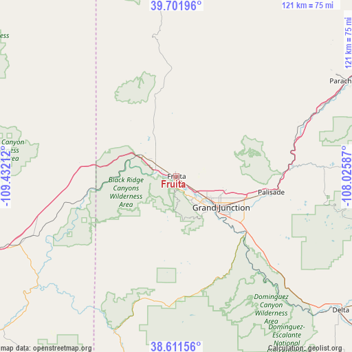
Fruita GPS coordinates[2]
39° 9' 31.932" North, 108° 43' 44.364" West
| Map corner | latitude | longitude |
|---|---|---|
| Upper-left | 39.70196°, | -109.43212° |
| Center: | 39.15887°, | -108.72899° |
| Lower-right: | 38.61156°, | -108.02587° |
| Map W x H: | 121.2×121.2 km | = 75.3×75.3mi |
| max Lat: | 71.29058° ⇑53.4% North |
| Fruita: | 39.15887° |
| min Lat: | ⇓46.6% South 19.06759° |
| min Long | Fruita | max Long |
| -171.73463° | -108.72899° | -66.98998° |
| W 14.7%⇐ | ⇒85.3% E |
Elevation
Elevation of Fruita is 1380 m = 4528 ft, and this is 1085.2 m = 3560 ft above average elevation for this country.
| Max E: |
3189 m = 10463 ft | 4.2% |
| Fruita | 1380 m 4528 ft | |
| Avg. | 294.8 m = 967 ft | |
Min E: |
-60 m = -197 ft | 95.8% |
See also: United States elevation on elevation.city.
Geographical zone
Fruita is located in North temperate zone (between Tropic of Cancer and the Arctic Circle). Distance of this Northern Tropic circle is 1748.1 km =1086.2 mi to South.| Distance of | km | miles | from Fruita |
|---|---|---|---|
| North Pole | 5653 | 3512.6 | to North |
| Arctic Circle | 3047.1 | 1893.4 | to North |
| Tropic Cancer | 1748.1 | 1086.2 | to South |
| Equator | 4354.1 | 2705.5 | to South |


Nearby cities:
15 places around Fruita: (largest is in red/bold)
• Battlement Mesa
68.2 km =42.4 mi,  62°
62°
• Cedaredge
75 km =46.6 mi,  112°
112°
• Clifton
25.3 km =15.7 mi, 107°
• Collbran
66.8 km =41.5 mi,  82°
82°
• Delta
73.5 km =45.7 mi,  129°
129°
• Fruitvale
21.8 km =13.5 mi, 113°
• Grand Junction
18.7 km =11.6 mi,  124°
124°
• Loma
8.3 km =5.2 mi,  299°
299°
• Olathe
89.3 km =55.5 mi, 133°
• Orchard City
75.1 km =46.7 mi, 119°
• Orchard Mesa
20 km =12.4 mi, 130°
• Palisade
33.1 km =20.6 mi,  99°
99°
• Parachute
66.7 km =41.4 mi, 60°
• Redlands
12 km =7.5 mi,  137°
137°
• Rifle
91.4 km =56.8 mi, 62°
Sources, notices
• [Note1] Compared only with cities in United States existing in our database
• [Src1] Map data: © OpenStreetMap contributors (CC-BY-SA)
• [Src2] Other city data from geonames.org with taken over terms of usage.
• [Src3] Geographical zone / Annual Mean Temperature by Robert A. Rohde @ Wikipedia
