Cold Springs geodata
Cold Springs (Nevada) is a populated place; located in United States in America/Los_Angeles (GMT-7) time zone. With population of 8,544 people, there are 4994 cities with bigger population in this country. Compared to other cities in United States, 50.5% of cities are located further ↓South; 92.8% of cities are located further →East and 97.1% of cities have lower elevation than Cold Springs. Note1


Cold Springs GPS coordinates[2]
39° 40' 48.684" North, 119° 58' 35.724" West
| Map corner | latitude | longitude |
|---|---|---|
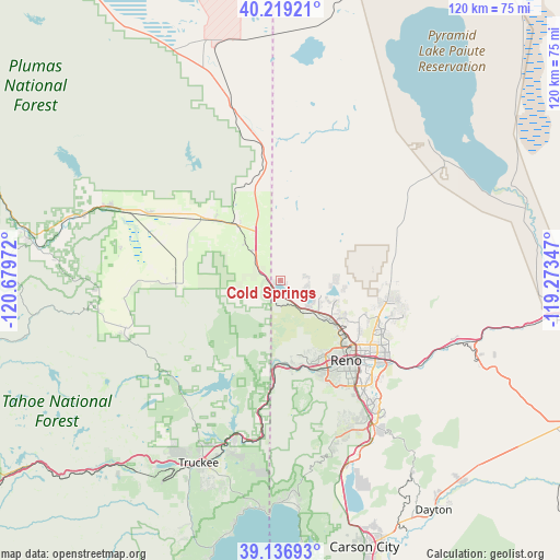
| Upper-left | 40.21921°, | -120.67972° |
| Center: | 39.68019°, | -119.97659° |
| Lower-right: | 39.13693°, | -119.27347° |
| Map W x H: | 120.3×120.3 km | = 74.8×74.8mi |
| max Lat: | 71.29058° ⇑49.5% North |
| Cold Springs: | 39.68019° |
| min Lat: | ⇓50.5% South 19.06759° |
| min Long | Cold Springs | max Long |
| -171.73463° | -119.97659° | -66.98998° |
| W 7.2%⇐ | ⇒92.8% E |
Elevation
Elevation of Cold Springs is 1543 m = 5062 ft, and this is 1248.2 m = 4095 ft above average elevation for this country.
| Max E: |
3189 m = 10463 ft | 2.9% |
| Cold Springs | 1543 m 5062 ft | |
| Avg. | 294.8 m = 967 ft | |
Min E: |
-60 m = -197 ft | 97.1% |
See also: United States elevation on elevation.city.
Geographical zone
Cold Springs is located in North temperate zone (between Tropic of Cancer and the Arctic Circle). Distance of this Northern Tropic circle is 1806.1 km =1122.3 mi to South.| Distance of | km | miles | from Cold Springs |
|---|---|---|---|
| North Pole | 5595 | 3476.6 | to North |
| Arctic Circle | 2989.2 | 1857.4 | to North |
| Tropic Cancer | 1806.1 | 1122.3 | to South |
| Equator | 4412 | 2741.5 | to South |


Nearby cities:
15 places around Cold Springs: (largest is in red/bold)
• Delleker
46.8 km =29.1 mi,  287°
287°
• Doyle
40.2 km =25 mi,  344°
344°
• Golden Valley
14.7 km =9.1 mi,  119°
119°
• Incline Village
47.7 km =29.6 mi,  179°
179°
• Kings Beach
49.4 km =30.7 mi, 184°
• Lemmon Valley
12.4 km =7.7 mi,  113°
113°
• Loyalton
22.6 km =14 mi,  268°
268°
• Mogul
19 km =11.8 mi,  166°
166°
• Portola
44.5 km =27.7 mi, 288°
• Reno
21.8 km =13.5 mi,  140°
140°
• Spanish Springs
23.3 km =14.5 mi,  98°
98°
• Sparks
25.1 km =15.6 mi,  130°
130°
• Sun Valley
19.5 km =12.1 mi, 118°
• Truckee
43 km =26.7 mi,  204°
204°
• Verdi
18 km =11.2 mi, 183°
Sources, notices
• [Note1] Compared only with cities in United States existing in our database
• [Src1] Map data: © OpenStreetMap contributors (CC-BY-SA)
• [Src2] Other city data from geonames.org with taken over terms of usage.
• [Src3] Geographical zone / Annual Mean Temperature by Robert A. Rohde @ Wikipedia
