Morton geodata
Morton (Texas) is a seat of a second-order administrative division; located in United States in America/Chicago (GMT-5) time zone. With population of 1,892 people, there are 12248 cities with bigger population in this country. Compared to other cities in United States, 82% of cities are located further ↑North; 82.2% of cities are located further →East and 94.3% of cities have lower elevation than Morton. Note1


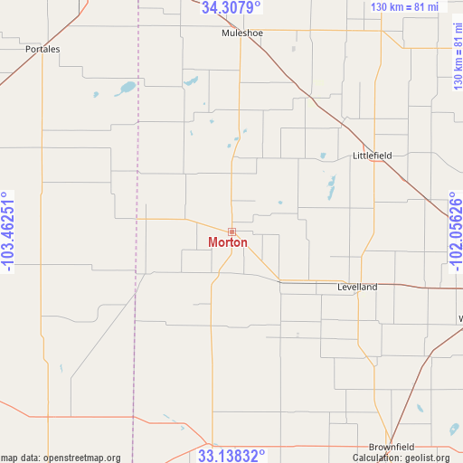
Morton GPS coordinates[2]
33° 43' 30.36" North, 102° 45' 33.768" West
| Map corner | latitude | longitude |
|---|---|---|
| Upper-left | 34.3079°, | -103.46251° |
| Center: | 33.7251°, | -102.75938° |
| Lower-right: | 33.13832°, | -102.05626° |
| Map W x H: | 130×130 km | = 80.8×80.8mi |
| max Lat: | 71.29058° ⇑82% North |
| Morton: | 33.7251° |
| min Lat: | ⇓18% South 19.06759° |
| min Long | Morton | max Long |
| -171.73463° | -102.75938° | -66.98998° |
| W 17.8%⇐ | ⇒82.2% E |
Elevation
Elevation of Morton is 1148 m = 3766 ft, and this is 853.2 m = 2799 ft above average elevation for this country.
| Max E: |
3189 m = 10463 ft | 5.7% |
| Morton | 1148 m 3766 ft | |
| Avg. | 294.8 m = 967 ft | |
Min E: |
-60 m = -197 ft | 94.3% |
See also: United States elevation on elevation.city.
Geographical zone
Morton is located in North temperate zone (between Tropic of Cancer and the Arctic Circle). Distance of this Northern Tropic circle is 1144 km =710.8 mi to South.| Distance of | km | miles | from Morton |
|---|---|---|---|
| North Pole | 6257.2 | 3888 | to North |
| Arctic Circle | 3651.3 | 2268.8 | to North |
| Tropic Cancer | 1144 | 710.8 | to South |
| Equator | 3749.9 | 2330.1 | to South |


Nearby cities:
15 places around Morton: (largest is in red/bold)
• Amherst
44.9 km =27.9 mi,  45°
45°
• Anton
55.9 km =34.7 mi,  80°
80°
• Brownfield
75.4 km =46.9 mi,  143°
143°
• Earth
65 km =40.4 mi,  29°
29°
• Levelland
38.5 km =23.9 mi,  113°
113°
• Littlefield
45.5 km =28.3 mi,  61°
61°
• Meadow
67 km =41.6 mi,  130°
130°
• Muleshoe
55.8 km =34.7 mi,  3°
3°
• Plains
60 km =37.3 mi,  186°
186°
• Portales
73.8 km =45.9 mi,  314°
314°
• Shallowater
70.5 km =43.8 mi,  93°
93°
• Sudan
43.9 km =27.3 mi, 29°
• Sundown
39 km =24.2 mi, 140°
• Tatum
73.4 km =45.6 mi,  224°
224°
• Wolfforth
73.6 km =45.7 mi, 109°
Sources, notices
• [Note1] Compared only with cities in United States existing in our database
• [Src1] Map data: © OpenStreetMap contributors (CC-BY-SA)
• [Src2] Other city data from geonames.org with taken over terms of usage.
• [Src3] Geographical zone / Annual Mean Temperature by Robert A. Rohde @ Wikipedia
