Hermiston geodata
Hermiston (Oregon) is a populated place; located in United States in America/Los_Angeles (GMT-7) time zone. With population of 17,201 people, there are 2880 cities with bigger population in this country. Compared to other cities in United States, 94.8% of cities are located further ↓South; 92.2% of cities are located further →East and 62.7% of cities have higher elevation than Hermiston. Note1


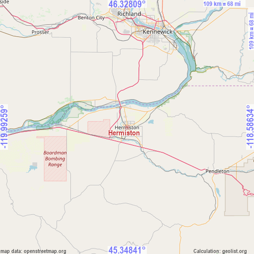
Hermiston GPS coordinates[2]
45° 50' 25.476" North, 119° 17' 22.056" West
| Map corner | latitude | longitude |
|---|---|---|
| Upper-left | 46.32809°, | -119.99259° |
| Center: | 45.84041°, | -119.28946° |
| Lower-right: | 45.34841°, | -118.58634° |
| Map W x H: | 108.9×108.9 km | = 67.7×67.7mi |
| max Lat: | 71.29058° ⇑5.2% North |
| Hermiston: | 45.84041° |
| min Lat: | ⇓94.8% South 19.06759° |
| min Long | Hermiston | max Long |
| -171.73463° | -119.28946° | -66.98998° |
| W 7.8%⇐ | ⇒92.2% E |
Elevation
Elevation of Hermiston is 140 m = 459 ft, and this is 154.8 m = 508 ft below average elevation for this country.
| Max E: |
3189 m = 10463 ft | 62.7% |
| Avg. | 294.8 m = 967 ft | |
| Hermiston | 140 m = 459 ft | |
Min E: |
-60 m = -197 ft | 37.3% |
See also: United States elevation on elevation.city.
Geographical zone
Hermiston is located in North temperate zone (between Tropic of Cancer and the Arctic Circle). Distance of this North polar circle is 2304.2 km =1431.8 mi to North.| Distance of | km | miles | from Hermiston |
|---|---|---|---|
| North Pole | 4910.1 | 3051 | to North |
| Arctic Circle | 2304.2 | 1431.8 | to North |
| Tropic Cancer | 2491.1 | 1547.9 | to South |
| Equator | 5097 | 3167.1 | to South |


Nearby cities:
15 places around Hermiston: (largest is in red/bold)
• Benton City
49.4 km =30.7 mi,  341°
341°
• Boardman
31.8 km =19.8 mi,  269°
269°
• Burbank
45.3 km =28.1 mi,  28°
28°
• Echo
13.1 km =8.1 mi,  146°
146°
• Finley
40.1 km =24.9 mi, 29°
• Highland
35.1 km =21.8 mi,  22°
22°
• Irrigon
16.8 km =10.4 mi,  291°
291°
• Kennewick
42.9 km =26.7 mi, 15°
• Mission
50.7 km =31.5 mi,  111°
111°
• Pasco
46.7 km =29 mi, 18°
• Pendleton
43.1 km =26.8 mi,  115°
115°
• Richland
49.5 km =30.8 mi,  0°
0°
• Stanfield
8.7 km =5.4 mi,  140°
140°
• Umatilla
9.5 km =5.9 mi,  334°
334°
• West Pasco
45.8 km =28.5 mi,  10°
10°
Sources, notices
• [Note1] Compared only with cities in United States existing in our database
• [Src1] Map data: © OpenStreetMap contributors (CC-BY-SA)
• [Src2] Other city data from geonames.org with taken over terms of usage.
• [Src3] Geographical zone / Annual Mean Temperature by Robert A. Rohde @ Wikipedia
