Dayton geodata
Dayton (Washington) is a seat of a second-order administrative division; located in United States in America/Los_Angeles (GMT-7) time zone. With population of 2,526 people, there are 10552 cities with bigger population in this country. Compared to other cities in United States, 95.5% of cities are located further ↓South; 90.8% of cities are located further →East and 88% of cities have lower elevation than Dayton. Note1


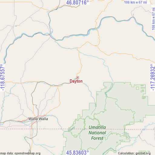
Dayton GPS coordinates[2]
46° 19' 25.5" North, 117° 58' 20.784" West
| Map corner | latitude | longitude |
|---|---|---|
| Upper-left | 46.80716°, | -118.67557° |
| Center: | 46.32375°, | -117.97244° |
| Lower-right: | 45.83603°, | -117.26932° |
| Map W x H: | 108×108 km | = 67.1×67.1mi |
| max Lat: | 71.29058° ⇑4.5% North |
| Dayton: | 46.32375° |
| min Lat: | ⇓95.5% South 19.06759° |
| min Long | Dayton | max Long |
| -171.73463° | -117.97244° | -66.98998° |
| W 9.2%⇐ | ⇒90.8% E |
Elevation
Elevation of Dayton is 505 m = 1657 ft, and this is 210.2 m = 690 ft above average elevation for this country.
| Max E: |
3189 m = 10463 ft | 12% |
| Dayton | 505 m 1657 ft | |
| Avg. | 294.8 m = 967 ft | |
Min E: |
-60 m = -197 ft | 88% |
See also: United States elevation on elevation.city.
Geographical zone
Dayton is located in North temperate zone (between Tropic of Cancer and the Arctic Circle). Distance of this North polar circle is 2250.5 km =1398.4 mi to North.| Distance of | km | miles | from Dayton |
|---|---|---|---|
| North Pole | 4856.3 | 3017.6 | to North |
| Arctic Circle | 2250.5 | 1398.4 | to North |
| Tropic Cancer | 2544.8 | 1581.3 | to South |
| Equator | 5150.7 | 3200.5 | to South |


Nearby cities:
15 places around Dayton: (largest is in red/bold)
• Asotin
71 km =44.1 mi,  88°
88°
• Athena
69.6 km =43.2 mi,  215°
215°
• Clarkston
71.9 km =44.7 mi,  81°
81°
• Clarkston Heights-Vineland
68.6 km =42.6 mi, 84°
• College Place
44.2 km =27.5 mi,  226°
226°
• Garrett
44.8 km =27.8 mi, 227°
• Lewiston
74 km =46 mi, 81°
• Milton-Freewater
54 km =33.6 mi, 216°
• Pomeroy
33 km =20.5 mi,  59°
59°
• Pullman
75.7 km =47 mi,  53°
53°
• Waitsburg
15.1 km =9.4 mi,  246°
246°
• Walla Walla
40.5 km =25.2 mi, 224°
• Walla Walla East
39.6 km =24.6 mi, 220°
• West Clarkston-Highland
70.3 km =43.7 mi, 82°
• Weston
66.6 km =41.4 mi,  211°
211°
Sources, notices
• [Note1] Compared only with cities in United States existing in our database
• [Src1] Map data: © OpenStreetMap contributors (CC-BY-SA)
• [Src2] Other city data from geonames.org with taken over terms of usage.
• [Src3] Geographical zone / Annual Mean Temperature by Robert A. Rohde @ Wikipedia
