Waitsburg geodata
Waitsburg (Washington) is a populated place; located in United States in America/Los_Angeles (GMT-7) time zone. With population of 1,191 people, there are 15173 cities with bigger population in this country. Compared to other cities in United States, 95.4% of cities are located further ↓South; 91.1% of cities are located further →East and 82.5% of cities have lower elevation than Waitsburg. Note1


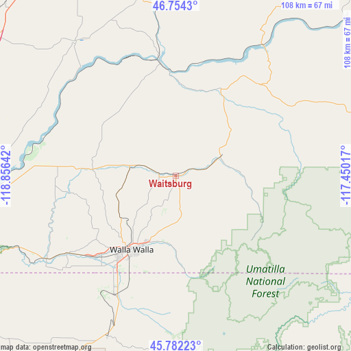
Waitsburg GPS coordinates[2]
46° 16' 13.512" North, 118° 9' 11.844" West
| Map corner | latitude | longitude |
|---|---|---|
| Upper-left | 46.7543°, | -118.85642° |
| Center: | 46.27042°, | -118.15329° |
| Lower-right: | 45.78223°, | -117.45017° |
| Map W x H: | 108.1×108.1 km | = 67.2×67.2mi |
| max Lat: | 71.29058° ⇑4.6% North |
| Waitsburg: | 46.27042° |
| min Lat: | ⇓95.4% South 19.06759° |
| min Long | Waitsburg | max Long |
| -171.73463° | -118.15329° | -66.98998° |
| W 8.9%⇐ | ⇒91.1% E |
Elevation
Elevation of Waitsburg is 382 m = 1253 ft, and this is 87.2 m = 286 ft above average elevation for this country.
| Max E: |
3189 m = 10463 ft | 17.5% |
| Waitsburg | 382 m 1253 ft | |
| Avg. | 294.8 m = 967 ft | |
Min E: |
-60 m = -197 ft | 82.5% |
See also: United States elevation on elevation.city.
Geographical zone
Waitsburg is located in North temperate zone (between Tropic of Cancer and the Arctic Circle). Distance of this North polar circle is 2256.4 km =1402.1 mi to North.| Distance of | km | miles | from Waitsburg |
|---|---|---|---|
| North Pole | 4862.3 | 3021.3 | to North |
| Arctic Circle | 2256.4 | 1402.1 | to North |
| Tropic Cancer | 2538.9 | 1577.6 | to South |
| Equator | 5144.8 | 3196.8 | to South |


Nearby cities:
15 places around Waitsburg: (largest is in red/bold)
• Athena
57.3 km =35.6 mi,  207°
207°
• Burbank
66.6 km =41.4 mi,  263°
263°
• College Place
30.5 km =19 mi,  216°
216°
• Connell
69.6 km =43.2 mi,  308°
308°
• Dayton
15.1 km =9.4 mi,  66°
66°
• Finley
69 km =42.9 mi, 259°
• Garrett
31 km =19.3 mi, 218°
• Highland
75.5 km =46.9 mi, 258°
• Kennewick
76 km =47.2 mi,  265°
265°
• Milton-Freewater
41.7 km =25.9 mi, 205°
• Pasco
72.9 km =45.3 mi, 267°
• Pomeroy
48 km =29.8 mi,  61°
61°
• Walla Walla
27.2 km =16.9 mi, 212°
• Walla Walla East
26.9 km =16.7 mi, 205°
• Weston
54.9 km =34.1 mi,  202°
202°
Sources, notices
• [Note1] Compared only with cities in United States existing in our database
• [Src1] Map data: © OpenStreetMap contributors (CC-BY-SA)
• [Src2] Other city data from geonames.org with taken over terms of usage.
• [Src3] Geographical zone / Annual Mean Temperature by Robert A. Rohde @ Wikipedia
