Gillette geodata
Gillette (Wyoming) is a seat of a second-order administrative division; located in United States in America/Denver (GMT-6) time zone. With population of 32,649 people, there are 1528 cities with bigger population in this country. Compared to other cities in United States, 89.6% of cities are located further ↓South; 83.6% of cities are located further →East and 95.9% of cities have lower elevation than Gillette. Note1


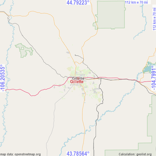
Gillette GPS coordinates[2]
44° 17' 27.924" North, 105° 30' 7.992" West
| Map corner | latitude | longitude |
|---|---|---|
| Upper-left | 44.79223°, | -106.20535° |
| Center: | 44.29109°, | -105.50222° |
| Lower-right: | 43.78564°, | -104.7991° |
| Map W x H: | 111.9×111.9 km | = 69.5×69.5mi |
| max Lat: | 71.29058° ⇑10.4% North |
| Gillette: | 44.29109° |
| min Lat: | ⇓89.6% South 19.06759° |
| min Long | Gillette | max Long |
| -171.73463° | -105.50222° | -66.98998° |
| W 16.4%⇐ | ⇒83.6% E |
Elevation
Elevation of Gillette is 1393 m = 4570 ft, and this is 1098.2 m = 3603 ft above average elevation for this country.
| Max E: |
3189 m = 10463 ft | 4.1% |
| Gillette | 1393 m 4570 ft | |
| Avg. | 294.8 m = 967 ft | |
Min E: |
-60 m = -197 ft | 95.9% |
See also: United States elevation on elevation.city.
Geographical zone
Gillette is located in North temperate zone (between Tropic of Cancer and the Arctic Circle). Distance of this Northern Tropic circle is 2318.8 km =1440.8 mi to South.| Distance of | km | miles | from Gillette |
|---|---|---|---|
| North Pole | 5082.4 | 3158.1 | to North |
| Arctic Circle | 2476.5 | 1538.8 | to North |
| Tropic Cancer | 2318.8 | 1440.8 | to South |
| Equator | 4924.7 | 3060.1 | to South |


Nearby cities:
15 places around Gillette: (largest is in red/bold)
• Antelope Valley-Crestview
7.7 km =4.8 mi,  163°
163°
• Belle Fourche
137.6 km =85.5 mi,  72°
72°
• Broadus
128.4 km =79.8 mi,  3°
3°
• Buffalo
95.4 km =59.3 mi,  273°
273°
• Moorcroft
44 km =27.3 mi,  94°
94°
• Newcastle
114.4 km =71.1 mi,  115°
115°
• North Spearfish
130.1 km =80.8 mi,  79°
79°
• Pine Haven
55.5 km =34.5 mi, 82°
• Sheridan
128.2 km =79.7 mi,  296°
296°
• Sleepy Hollow
8.5 km =5.3 mi,  131°
131°
• Spearfish
132.4 km =82.3 mi, 80°
• Story
114.4 km =71.1 mi,  286°
286°
• Sundance
90.5 km =56.2 mi, 81°
• Upton
72.9 km =45.3 mi,  106°
106°
• Wright
60 km =37.3 mi,  179°
179°
Sources, notices
• [Note1] Compared only with cities in United States existing in our database
• [Src1] Map data: © OpenStreetMap contributors (CC-BY-SA)
• [Src2] Other city data from geonames.org with taken over terms of usage.
• [Src3] Geographical zone / Annual Mean Temperature by Robert A. Rohde @ Wikipedia
