Antelope Valley-Crestview geodata
Antelope Valley-Crestview (Wyoming) is a populated place; located in United States in America/Denver (GMT-6) time zone. With population of 1,658 people, there are 13056 cities with bigger population in this country. Compared to other cities in United States, 89.3% of cities are located further ↓South; 83.6% of cities are located further →East and 96.1% of cities have lower elevation than Antelope Valley-Crestview. Note1
Current local time in Antelope Valley-Crestview:
01:54 AM, WednesdayDifference from your time zone: hours


Antelope Valley-Crestview GPS coordinates[2]
44° 13' 29.568" North, 105° 28' 26.724" West
| Map corner | latitude | longitude |
|---|---|---|
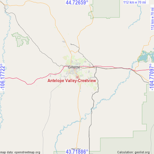
| Upper-left | 44.72659°, | -106.17722° |
| Center: | 44.22488°, | -105.47409° |
| Lower-right: | 43.71886°, | -104.77097° |
| Map W x H: | 112×112 km | = 69.6×69.6mi |
| max Lat: | 71.29058° ⇑10.7% North |
| Antelope Valley-Crestview: | 44.22488° |
| min Lat: | ⇓89.3% South 19.06759° |
| min Long | Antelope Valley | max Long |
| -171.73463° | -105.47409° | -66.98998° |
| W 16.4%⇐ | ⇒83.6% E |
Elevation
Elevation of Antelope Valley-Crestview is 1421 m = 4662 ft, and this is 1126.2 m = 3695 ft above average elevation for this country.
| Max E: |
3189 m = 10463 ft | 3.9% |
| Antelope Valley-Crestview | 1421 m 4662 ft | |
| Avg. | 294.8 m = 967 ft | |
Min E: |
-60 m = -197 ft | 96.1% |
See also: United States elevation on elevation.city.
Geographical zone
Antelope Valley-Crestview is located in North temperate zone (between Tropic of Cancer and the Arctic Circle). Distance of this Northern Tropic circle is 2311.4 km =1436.2 mi to South.| Distance of | km | miles | from Antelope Valley-Crestview |
|---|---|---|---|
| North Pole | 5089.7 | 3162.6 | to North |
| Arctic Circle | 2483.8 | 1543.4 | to North |
| Tropic Cancer | 2311.4 | 1436.2 | to South |
| Equator | 4917.3 | 3055.5 | to South |


Nearby cities:
15 places around Antelope Valley-Crestview: (largest is in red/bold)
• Broadus
135.6 km =84.3 mi,  2°
2°
• Buffalo
98.5 km =61.2 mi,  278°
278°
• Gillette
7.7 km =4.8 mi,  343°
343°
• Lead
136.7 km =84.9 mi,  84°
84°
• Moorcroft
41.9 km =26 mi, 84°
• Newcastle
109.5 km =68 mi,  112°
112°
• North Spearfish
129.6 km =80.5 mi, 76°
• Pine Haven
54.8 km =34.1 mi,  74°
74°
• Sheridan
133.6 km =83 mi,  298°
298°
• Sleepy Hollow
4.5 km =2.8 mi, 66°
• Spearfish
131.7 km =81.8 mi, 77°
• Story
118.8 km =73.8 mi,  289°
289°
• Sundance
89.7 km =55.7 mi, 76°
• Upton
68.9 km =42.8 mi,  101°
101°
• Wright
52.7 km =32.7 mi,  181°
181°
Sources, notices
• [Note1] Compared only with cities in United States existing in our database
• [Src1] Map data: © OpenStreetMap contributors (CC-BY-SA)
• [Src2] Other city data from geonames.org with taken over terms of usage.
• [Src3] Geographical zone / Annual Mean Temperature by Robert A. Rohde @ Wikipedia
