Saratoga geodata
Saratoga (Wyoming) is a populated place; located in United States in America/Denver (GMT-6) time zone. With population of 1,677 people, there are 12990 cities with bigger population in this country. Compared to other cities in United States, 70.4% of cities are located further ↓South; 84.6% of cities are located further →East and 99.3% of cities have lower elevation than Saratoga. Note1


Saratoga GPS coordinates[2]
41° 27' 17.856" North, 106° 48' 23.148" West
| Map corner | latitude | longitude |
|---|---|---|
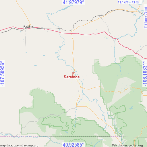
| Upper-left | 41.97979°, | -107.50956° |
| Center: | 41.45496°, | -106.80643° |
| Lower-right: | 40.92585°, | -106.10331° |
| Map W x H: | 117.2×117.2 km | = 72.8×72.8mi |
| max Lat: | 71.29058° ⇑29.6% North |
| Saratoga: | 41.45496° |
| min Lat: | ⇓70.4% South 19.06759° |
| min Long | Saratoga | max Long |
| -171.73463° | -106.80643° | -66.98998° |
| W 15.4%⇐ | ⇒84.6% E |
Elevation
Elevation of Saratoga is 2073 m = 6801 ft, and this is 1778.2 m = 5834 ft above average elevation for this country.
| Max E: |
3189 m = 10463 ft | 0.7% |
| Saratoga | 2073 m 6801 ft | |
| Avg. | 294.8 m = 967 ft | |
Min E: |
-60 m = -197 ft | 99.3% |
See also: United States elevation on elevation.city.
Geographical zone
Saratoga is located in North temperate zone (between Tropic of Cancer and the Arctic Circle). Distance of this Northern Tropic circle is 2003.4 km =1244.9 mi to South.| Distance of | km | miles | from Saratoga |
|---|---|---|---|
| North Pole | 5397.7 | 3354 | to North |
| Arctic Circle | 2791.8 | 1734.7 | to North |
| Tropic Cancer | 2003.4 | 1244.9 | to South |
| Equator | 4609.4 | 2864.1 | to South |


Nearby cities:
15 places around Saratoga: (largest is in red/bold)
• Casper
162.1 km =100.7 mi,  14°
14°
• Craig
121.6 km =75.6 mi,  210°
210°
• Estes Park
161.3 km =100.2 mi,  137°
137°
• Evansville
162.4 km =100.9 mi,  15°
15°
• Hanna
50.4 km =31.3 mi, 23°
• Hartrandt
163.7 km =101.7 mi, 13°
• Hayden
113.2 km =70.3 mi,  199°
199°
• Kremmling
159.2 km =98.9 mi,  167°
167°
• Laramie
102.6 km =63.8 mi,  98°
98°
• Mills
158.3 km =98.4 mi, 13°
• Oak Creek
131.8 km =81.9 mi,  185°
185°
• Rawlins
51.8 km =32.2 mi,  316°
316°
• Steamboat Springs
107.9 km =67 mi,  181°
181°
• Vista West
160 km =99.4 mi, 11°
• Walden
91.6 km =56.9 mi,  151°
151°
Sources, notices
• [Note1] Compared only with cities in United States existing in our database
• [Src1] Map data: © OpenStreetMap contributors (CC-BY-SA)
• [Src2] Other city data from geonames.org with taken over terms of usage.
• [Src3] Geographical zone / Annual Mean Temperature by Robert A. Rohde @ Wikipedia
