Kahuku geodata
Kahuku (Hawaii) is a populated place; located in United States in Pacific/Honolulu (GMT-10) time zone. With population of 2,614 people, there are 10370 cities with bigger population in this country. Compared to other cities in United States, 99.5% of cities are located further ↑North; 99.6% of cities are located further →East and 98.1% of cities have higher elevation than Kahuku. Note1


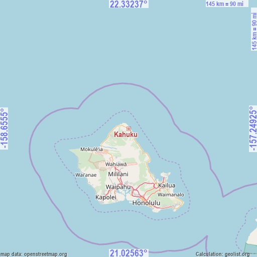
Kahuku GPS coordinates[2]
21° 40' 49.728" North, 157° 57' 8.532" West
| Map corner | latitude | longitude |
|---|---|---|
| Upper-left | 22.33237°, | -158.6555° |
| Center: | 21.68048°, | -157.95237° |
| Lower-right: | 21.02563°, | -157.24925° |
| Map W x H: | 145.3×145.3 km | = 90.3×90.3mi |
| max Lat: | 71.29058° ⇑99.5% North |
| Kahuku: | 21.68048° |
| min Lat: | ⇓0.5% South 19.06759° |
| min Long | Kahuku | max Long |
| -171.73463° | -157.95237° | -66.98998° |
| W 0.4%⇐ | ⇒99.6% E |
Elevation
Elevation of Kahuku is 5 m = 16 ft, and this is 289.8 m = 951 ft below average elevation for this country.
| Max E: |
3189 m = 10463 ft | 98.1% |
| Avg. | 294.8 m = 967 ft | |
| Kahuku | 5 m = 16 ft | |
Min E: |
-60 m = -197 ft | 1.9% |
See also: United States elevation on elevation.city.
Geographical zone
Kahuku is located in North Torrid zone (between Equator and Tropic of Cancer). Distance of this Northern Tropic circle is 195.3 km =121.4 mi to North.| Distance of | km | miles | from Kahuku |
|---|---|---|---|
| North Pole | 7596.4 | 4720.2 | to North |
| Arctic Circle | 4990.5 | 3101 | to North |
| Tropic Cancer | 195.3 | 121.4 | to North |
| Equator | 2410.6 | 1497.9 | to South |


Nearby cities:
15 places around Kahuku: (largest is in red/bold)
• Hale‘iwa
18.4 km =11.4 mi,  238°
238°
• Hau‘ula
9.3 km =5.8 mi,  150°
150°
• Ka‘a‘awa
17.5 km =10.9 mi,  143°
143°
• Lā‘ie
5 km =3.1 mi, 141°
• Mililani Town
26.1 km =16.2 mi,  191°
191°
• Mokulēia
23.6 km =14.7 mi, 241°
• Punaluu
14.1 km =8.8 mi, 147°
• Punalu‘u
14.6 km =9.1 mi, 147°
• Pupukea
11.6 km =7.2 mi,  255°
255°
• Schofield Barracks
23.4 km =14.5 mi,  209°
209°
• Wahiawā
21.1 km =13.1 mi,  200°
200°
• Waialua
21.8 km =13.5 mi, 238°
• Waikane
23 km =14.3 mi, 153°
• Waipi‘o Acres
24.8 km =15.4 mi, 194°
• Whitmore Village
19.9 km =12.4 mi, 202°
Sources, notices
• [Note1] Compared only with cities in United States existing in our database
• [Src1] Map data: © OpenStreetMap contributors (CC-BY-SA)
• [Src2] Other city data from geonames.org with taken over terms of usage.
• [Src3] Geographical zone / Annual Mean Temperature by Robert A. Rohde @ Wikipedia
