Grand Forks Air Force Base geodata
Grand Forks Air Force Base (North Dakota) is a populated place; located in United States in America/Chicago (GMT-5) time zone. With population of 2,367 people, there are 10933 cities with bigger population in this country. Compared to other cities in United States, 98.5% of cities are located further ↓South; 76.8% of cities are located further →East and 67% of cities have lower elevation than Grand Forks Air Force Base. Note1
Administrative division(s):
- Level 1: North Dakota
- Level 2: Grand Forks County
- Level 3: Township of Mekinock
Current local time in Grand Forks Air Force Base:
03:58 AM, FridayDifference from your time zone: hours


Grand Forks Air Force Base GPS coordinates[2]
47° 57' 17.748" North, 97° 23' 11.904" West
| Map corner | latitude | longitude |
|---|---|---|
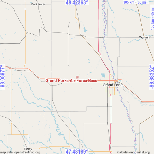
| Upper-left | 48.42368°, | -98.08977° |
| Center: | 47.95493°, | -97.38664° |
| Lower-right: | 47.48189°, | -96.68352° |
| Map W x H: | 104.7×104.7 km | = 65.1×65.1mi |
| max Lat: | 71.29058° ⇑1.5% North |
| Grand Forks Air Force Base: | 47.95493° |
| min Lat: | ⇓98.5% South 19.06759° |
| min Long | Grand Forks Air | max Long |
| -171.73463° | -97.38664° | -66.98998° |
| W 23.2%⇐ | ⇒76.8% E |
Elevation
Elevation of Grand Forks Air Force Base is 271 m = 889 ft, and this is 23.8 m = 78 ft below average elevation for this country.
| Max E: |
3189 m = 10463 ft | 33% |
| Avg. | 294.8 m = 967 ft | |
| Grand Forks Air Force Base | 271 m = 889 ft | |
Min E: |
-60 m = -197 ft | 67% |
See also: United States elevation on elevation.city.
Geographical zone
Grand Forks Air Force Base is located in North temperate zone (between Tropic of Cancer and the Arctic Circle). Distance of this North polar circle is 2069.1 km =1285.7 mi to North.| Distance of | km | miles | from Grand Forks Air Force Base |
|---|---|---|---|
| North Pole | 4675 | 2904.9 | to North |
| Arctic Circle | 2069.1 | 1285.7 | to North |
| Tropic Cancer | 2726.2 | 1694 | to South |
| Equator | 5332.1 | 3313.2 | to South |


Nearby cities:
15 places around Grand Forks Air Force Base: (largest is in red/bold)
• Argyle
59.4 km =36.9 mi,  44°
44°
• Crookston
61.5 km =38.2 mi,  109°
109°
• East Grand Forks
27.1 km =16.8 mi,  95°
95°
• Finley
59.4 km =36.9 mi,  214°
214°
• Grafton
50.9 km =31.6 mi,  357°
357°
• Grand Forks
26.6 km =16.5 mi, 97°
• Hatton
35.4 km =22 mi,  188°
188°
• Larimore
18.7 km =11.6 mi,  253°
253°
• Mayville
51 km =31.7 mi,  174°
174°
• Minto
37.5 km =23.3 mi,  1°
1°
• Northwood
28 km =17.4 mi, 208°
• Park River
55.9 km =34.7 mi,  331°
331°
• Portland
50.8 km =31.6 mi,  178°
178°
• Thompson
28.9 km =18 mi,  134°
134°
• Warren
52.9 km =32.9 mi,  59°
59°
Sources, notices
• [Note1] Compared only with cities in United States existing in our database
• [Src1] Map data: © OpenStreetMap contributors (CC-BY-SA)
• [Src2] Other city data from geonames.org with taken over terms of usage.
• [Src3] Geographical zone / Annual Mean Temperature by Robert A. Rohde @ Wikipedia
