Villa del Carmen geodata
Villa del Carmen (Durazno) is a populated place; located in Uruguay in America/Montevideo (GMT-3) time zone. With population of 2,703 people, there are 73 cities with bigger population in this country. Compared to other cities in Uruguay, 70.5% of cities are located further ↓South; 58.2% of cities are located further ←West and 90.2% of cities have lower elevation than Villa del Carmen. Note1


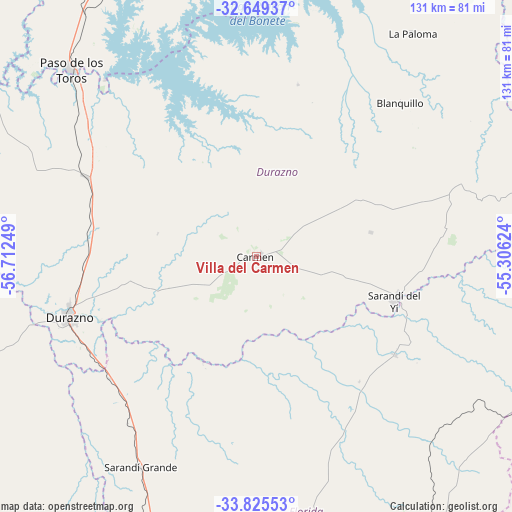
Villa del Carmen GPS coordinates[2]
33° 14' 21.948" South, 56° 0' 33.696" West
| Map corner | latitude | longitude |
|---|---|---|
| Upper-left | -32.64937°, | -56.71249° |
| Center: | -33.23943°, | -56.00936° |
| Lower-right: | -33.82553°, | -55.30624° |
| Map W x H: | 130.8×130.8 km | = 81.3×81.3mi |
| max Lat: | -30.25966° ⇑29.5% North |
| Villa del Carmen: | -33.23943° |
| min Lat: | ⇓70.5% South -34.94747° |
| min Long | Villa del Carme | max Long |
| -58.41176° | -56.00936° | -53.38583° |
| W 58.2%⇐ | ⇒41.8% E |
Elevation
Elevation of Villa del Carmen is 153 m = 502 ft, and this is 82.4 m = 270 ft above average elevation for this country.
| Max E: |
294 m = 965 ft | 9.8% |
| Villa del Carmen | 153 m 502 ft | |
| Avg. | 70.6 m = 232 ft | |
Min E: |
2 m = 7 ft | 90.2% |
See also: Uruguay elevation on elevation.city.
Geographical zone
Villa del Carmen is located in South temperate zone (between Tropic of Capricorn and the Antarctic Circle). Distance of this Southern Tropic circle is 1090 km =677.3 mi to North.| Distance of | km | miles | from Villa del Carmen |
|---|---|---|---|
| Equator | 3695.9 | 2296.5 | to North |
| Tropic Capricorn | 1090 | 677.3 | to North |
| Antarctic Circle | 3705.3 | 2302.4 | to South |
| South Pole | 6311.2 | 3921.6 | to South |


Nearby cities:
15 places around Villa del Carmen: (largest is in red/bold)
• 25 de Mayo
109.9 km =68.3 mi,  196°
196°
• Alejandro Gallinal
81.7 km =50.8 mi,  148°
148°
• Blanquillo
63.2 km =39.3 mi,  33°
33°
• Carlos Reyles
48 km =29.8 mi,  295°
295°
• Casupá
101.4 km =63 mi,  160°
160°
• Durazno
50.3 km =31.3 mi,  251°
251°
• Florida
97.1 km =60.3 mi,  191°
191°
• José Batlle y Ordóñez
86.7 km =53.9 mi,  106°
106°
• La Paloma
69.5 km =43.2 mi, 34°
• Paso de los Toros
66.7 km =41.4 mi,  314°
314°
• Santa Bernardina
49.6 km =30.8 mi,  255°
255°
• Santa Clara de Olimar
105.3 km =65.4 mi,  70°
70°
• Sarandí Grande
62.6 km =38.9 mi,  208°
208°
• Sarandí del Yi
37 km =23 mi, 109°
• Trinidad
88.2 km =54.8 mi, 249°
Sources, notices
• [Note1] Compared only with cities in Uruguay existing in our database
• [Src1] Map data: © OpenStreetMap contributors (CC-BY-SA)
• [Src2] Other city data from geonames.org with taken over terms of usage.
• [Src3] Geographical zone / Annual Mean Temperature by Robert A. Rohde @ Wikipedia
