La Paloma geodata
La Paloma (Durazno) is a populated place; located in Uruguay in America/Montevideo (GMT-3) time zone. With population of 1,567 people, there are 99 cities with bigger population in this country. Compared to other cities in Uruguay, 78.7% of cities are located further ↓South; 73% of cities are located further ←West and 89.3% of cities have lower elevation than La Paloma. Note1


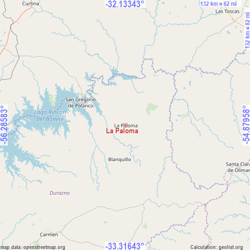
La Paloma GPS coordinates[2]
32° 43' 36.804" South, 55° 34' 57.72" West
| Map corner | latitude | longitude |
|---|---|---|
| Upper-left | -32.13343°, | -56.28583° |
| Center: | -32.72689°, | -55.5827° |
| Lower-right: | -33.31643°, | -54.87958° |
| Map W x H: | 131.5×131.5 km | = 81.7×81.7mi |
| max Lat: | -30.25966° ⇑21.3% North |
| La Paloma: | -32.72689° |
| min Lat: | ⇓78.7% South -34.94747° |
| min Long | La Paloma | max Long |
| -58.41176° | -55.5827° | -53.38583° |
| W 73%⇐ | ⇒27% E |
Elevation
Elevation of La Paloma is 146 m = 479 ft, and this is 75.4 m = 247 ft above average elevation for this country.
| Max E: |
294 m = 965 ft | 10.7% |
| La Paloma | 146 m 479 ft | |
| Avg. | 70.6 m = 232 ft | |
Min E: |
2 m = 7 ft | 89.3% |
See also: Uruguay elevation on elevation.city.
Geographical zone
La Paloma is located in South temperate zone (between Tropic of Capricorn and the Antarctic Circle). Distance of this Southern Tropic circle is 1033 km =641.9 mi to North.| Distance of | km | miles | from La Paloma |
|---|---|---|---|
| Equator | 3638.9 | 2261.1 | to North |
| Tropic Capricorn | 1033 | 641.9 | to North |
| Antarctic Circle | 3762.3 | 2337.8 | to South |
| South Pole | 6368.2 | 3957 | to South |


Nearby cities:
15 places around La Paloma: (largest is in red/bold)
• Alejandro Gallinal
126.3 km =78.5 mi,  178°
178°
• Blanquillo
6.5 km =4 mi,  226°
226°
• Carlos Reyles
91.1 km =56.6 mi,  246°
246°
• Curtina
81.4 km =50.6 mi,  322°
322°
• Durazno
113.9 km =70.8 mi, 230°
• José Batlle y Ordóñez
93 km =57.8 mi,  152°
152°
• Paso de los Toros
87.9 km =54.6 mi,  263°
263°
• Santa Bernardina
112.1 km =69.7 mi, 231°
• Santa Clara de Olimar
63.5 km =39.5 mi,  110°
110°
• Sarandí del Yi
69.4 km =43.1 mi, 183°
• Tacuarembó
118.4 km =73.6 mi,  341°
341°
• Treinta y Tres
125.2 km =77.8 mi,  116°
116°
• Tupambaé
77.2 km =48 mi,  98°
98°
• Villa Sara
123.3 km =76.6 mi, 118°
• Villa del Carmen
69.5 km =43.2 mi,  214°
214°
Sources, notices
• [Note1] Compared only with cities in Uruguay existing in our database
• [Src1] Map data: © OpenStreetMap contributors (CC-BY-SA)
• [Src2] Other city data from geonames.org with taken over terms of usage.
• [Src3] Geographical zone / Annual Mean Temperature by Robert A. Rohde @ Wikipedia
