Progreso geodata
Progreso (Canelones) is a populated place; located in Uruguay in America/Montevideo (GMT-3) time zone. With population of 15,973 people, there are 27 cities with bigger population in this country. Compared to other cities in Uruguay, 81.1% of cities are located further ↑North; 51.6% of cities are located further →East and 53.3% of cities have lower elevation than Progreso. Note1


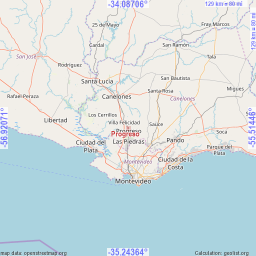
Progreso GPS coordinates[2]
34° 40' 2.532" South, 56° 13' 3.288" West
| Map corner | latitude | longitude |
|---|---|---|
| Upper-left | -34.08706°, | -56.92071° |
| Center: | -34.66737°, | -56.21758° |
| Lower-right: | -35.24364°, | -55.51446° |
| Map W x H: | 128.6×128.6 km | = 79.9×79.9mi |
| max Lat: | -30.25966° ⇑81.1% North |
| Progreso: | -34.66737° |
| min Lat: | ⇓18.9% South -34.94747° |
| min Long | Progreso | max Long |
| -58.41176° | -56.21758° | -53.38583° |
| W 48.4%⇐ | ⇒51.6% E |
Elevation
Elevation of Progreso is 56 m = 184 ft, and this is 14.6 m = 48 ft below average elevation for this country.
| Max E: |
294 m = 965 ft | 46.7% |
| Avg. | 70.6 m = 232 ft | |
| Progreso | 56 m = 184 ft | |
Min E: |
2 m = 7 ft | 53.3% |
See also: Uruguay elevation on elevation.city.
Geographical zone
Progreso is located in South temperate zone (between Tropic of Capricorn and the Antarctic Circle). Distance of this Southern Tropic circle is 1248.7 km =775.9 mi to North.| Distance of | km | miles | from Progreso |
|---|---|---|---|
| Equator | 3854.7 | 2395.2 | to North |
| Tropic Capricorn | 1248.7 | 775.9 | to North |
| Antarctic Circle | 3546.5 | 2203.7 | to South |
| South Pole | 6152.4 | 3822.9 | to South |


Nearby cities:
15 places around Progreso: (largest is in red/bold)
• Aguas Corrientes
22.8 km =14.2 mi,  315°
315°
• Barros Blancos
21.8 km =13.5 mi,  115°
115°
• Canelones
17 km =10.6 mi,  341°
341°
• Colonia Nicolich
24.1 km =15 mi,  132°
132°
• Delta del Tigre
17.3 km =10.7 mi,  231°
231°
• Joaquín Suárez
18.3 km =11.4 mi,  114°
114°
• Juanicó
8.7 km =5.4 mi, 338°
• La Paz
10.4 km =6.5 mi,  184°
184°
• Las Piedras
7 km =4.3 mi, 181°
• Los Cerrillos
14.5 km =9 mi,  298°
298°
• Pajas Blancas
18.3 km =11.4 mi,  215°
215°
• Pando
24.3 km =15.1 mi,  103°
103°
• Santiago Vázquez
18.3 km =11.4 mi, 221°
• Sauce
14.1 km =8.8 mi,  83°
83°
• Toledo
13.7 km =8.5 mi, 124°
Sources, notices
• [Note1] Compared only with cities in Uruguay existing in our database
• [Src1] Map data: © OpenStreetMap contributors (CC-BY-SA)
• [Src2] Other city data from geonames.org with taken over terms of usage.
• [Src3] Geographical zone / Annual Mean Temperature by Robert A. Rohde @ Wikipedia
