Juanicó geodata
Juanicó (Canelones) is a populated place; located in Uruguay in America/Montevideo (GMT-3) time zone. With population of 1,339 people, there are 105 cities with bigger population in this country. Compared to other cities in Uruguay, 76.2% of cities are located further ↑North; 54.1% of cities are located further →East and 59% of cities have higher elevation than Juanicó. Note1


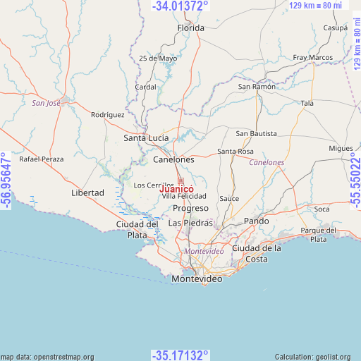
Juanicó GPS coordinates[2]
34° 35' 40.344" South, 56° 15' 12.024" West
| Map corner | latitude | longitude |
|---|---|---|
| Upper-left | -34.01372°, | -56.95647° |
| Center: | -34.59454°, | -56.25334° |
| Lower-right: | -35.17132°, | -55.55022° |
| Map W x H: | 128.7×128.7 km | = 80×80mi |
| max Lat: | -30.25966° ⇑76.2% North |
| Juanicó: | -34.59454° |
| min Lat: | ⇓23.8% South -34.94747° |
| min Long | Juanicó | max Long |
| -58.41176° | -56.25334° | -53.38583° |
| W 45.9%⇐ | ⇒54.1% E |
Elevation
Elevation of Juanicó is 43 m = 141 ft, and this is 27.6 m = 91 ft below average elevation for this country.
| Max E: |
294 m = 965 ft | 59% |
| Avg. | 70.6 m = 232 ft | |
| Juanicó | 43 m = 141 ft | |
Min E: |
2 m = 7 ft | 41% |
See also: Uruguay elevation on elevation.city.
Geographical zone
Juanicó is located in South temperate zone (between Tropic of Capricorn and the Antarctic Circle). Distance of this Southern Tropic circle is 1240.6 km =770.9 mi to North.| Distance of | km | miles | from Juanicó |
|---|---|---|---|
| Equator | 3846.6 | 2390.2 | to North |
| Tropic Capricorn | 1240.6 | 770.9 | to North |
| Antarctic Circle | 3554.6 | 2208.7 | to South |
| South Pole | 6160.5 | 3828 | to South |


Nearby cities:
15 places around Juanicó: (largest is in red/bold)
• 25 de Agosto
24.5 km =15.2 mi,  326°
326°
• Aguas Corrientes
15.2 km =9.4 mi,  302°
302°
• Canelones
8.3 km =5.2 mi,  344°
344°
• Delta del Tigre
21.5 km =13.4 mi,  208°
208°
• La Paz
18.6 km =11.6 mi,  172°
172°
• Las Piedras
15.4 km =9.6 mi, 168°
• Los Cerrillos
9.5 km =5.9 mi,  262°
262°
• Pajas Blancas
24.2 km =15 mi,  197°
197°
• Progreso
8.7 km =5.4 mi,  158°
158°
• San Antonio
22.5 km =14 mi,  44°
44°
• Santa Lucía
20.1 km =12.5 mi,  321°
321°
• Santa Rosa
22.4 km =13.9 mi,  61°
61°
• Santiago Vázquez
23.5 km =14.6 mi, 202°
• Sauce
18.4 km =11.4 mi,  110°
110°
• Toledo
21.6 km =13.4 mi,  137°
137°
Sources, notices
• [Note1] Compared only with cities in Uruguay existing in our database
• [Src1] Map data: © OpenStreetMap contributors (CC-BY-SA)
• [Src2] Other city data from geonames.org with taken over terms of usage.
• [Src3] Geographical zone / Annual Mean Temperature by Robert A. Rohde @ Wikipedia
