Treinta y Tres geodata
Treinta y Tres is a seat of a first-order administrative division; located in Uruguay in America/Montevideo (GMT-3) time zone. With population of 25,653 people, there are 15 cities with bigger population in this country. Compared to other cities in Uruguay, 71.3% of cities are located further ↓South; 89.3% of cities are located further ←West and 52.5% of cities have higher elevation than Treinta y Tres. Note1


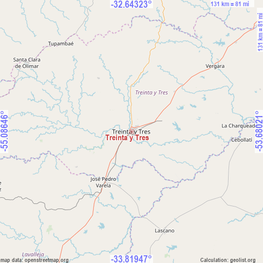
Treinta y Tres GPS coordinates[2]
33° 13' 59.988" South, 54° 22' 59.988" West
| Map corner | latitude | longitude |
|---|---|---|
| Upper-left | -32.64323°, | -55.08646° |
| Center: | -33.23333°, | -54.38333° |
| Lower-right: | -33.81947°, | -53.68021° |
| Map W x H: | 130.8×130.8 km | = 81.3×81.3mi |
| max Lat: | -30.25966° ⇑28.7% North |
| Treinta y Tres: | -33.23333° |
| min Lat: | ⇓71.3% South -34.94747° |
| min Long | Treinta y Tres | max Long |
| -58.41176° | -54.38333° | -53.38583° |
| W 89.3%⇐ | ⇒10.7% E |
Elevation
Elevation of Treinta y Tres is 52 m = 171 ft, and this is 18.6 m = 61 ft below average elevation for this country.
| Max E: |
294 m = 965 ft | 52.5% |
| Avg. | 70.6 m = 232 ft | |
| Treinta y Tres | 52 m = 171 ft | |
Min E: |
2 m = 7 ft | 47.5% |
See also: Uruguay elevation on elevation.city.
Geographical zone
Treinta y Tres is located in South temperate zone (between Tropic of Capricorn and the Antarctic Circle). Distance of this Southern Tropic circle is 1089.3 km =676.9 mi to North.| Distance of | km | miles | from Treinta y Tres |
|---|---|---|---|
| Equator | 3695.2 | 2296.1 | to North |
| Tropic Capricorn | 1089.3 | 676.9 | to North |
| Antarctic Circle | 3706 | 2302.8 | to South |
| South Pole | 6311.9 | 3922 | to South |


Nearby cities:
15 places around Treinta y Tres: (largest is in red/bold)
• Aiguá
113.4 km =70.5 mi,  197°
197°
• Cebollatí
54.9 km =34.1 mi,  93°
93°
• Chui
100.1 km =62.2 mi,  121°
121°
• Dieciocho de Julio
91.8 km =57 mi, 122°
• José Batlle y Ordóñez
72.9 km =45.3 mi,  249°
249°
• José Pedro Varela
28.4 km =17.6 mi,  209°
209°
• Lascano
51.5 km =32 mi,  161°
161°
• Mariscala
96.9 km =60.2 mi, 202°
• Melo
98.1 km =61 mi,  11°
11°
• Río Branco
116.9 km =72.6 mi,  52°
52°
• Santa Clara de Olimar
62.7 km =39 mi,  303°
303°
• Tupambaé
57.1 km =35.5 mi,  321°
321°
• Velázquez
89.8 km =55.8 mi,  173°
173°
• Vergara
52.5 km =32.6 mi, 52°
• Villa Sara
4 km =2.5 mi,  236°
236°
Sources, notices
• [Note1] Compared only with cities in Uruguay existing in our database
• [Src1] Map data: © OpenStreetMap contributors (CC-BY-SA)
• [Src2] Other city data from geonames.org with taken over terms of usage.
• [Src3] Geographical zone / Annual Mean Temperature by Robert A. Rohde @ Wikipedia
