Tupambaé geodata
Tupambaé (Cerro Largo) is a populated place; located in Uruguay in America/Montevideo (GMT-3) time zone. With population of 1,189 people, there are 111 cities with bigger population in this country. Compared to other cities in Uruguay, 76.2% of cities are located further ↓South; 85.2% of cities are located further ←West and 98.4% of cities have lower elevation than Tupambaé. Note1


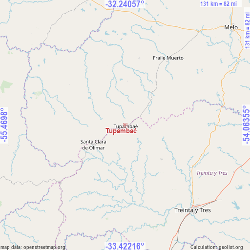
Tupambaé GPS coordinates[2]
32° 49' 59.988" South, 54° 46' 0.012" West
| Map corner | latitude | longitude |
|---|---|---|
| Upper-left | -32.24057°, | -55.4698° |
| Center: | -32.83333°, | -54.76667° |
| Lower-right: | -33.42216°, | -54.06355° |
| Map W x H: | 131.4×131.4 km | = 81.6×81.6mi |
| max Lat: | -30.25966° ⇑23.8% North |
| Tupambaé: | -32.83333° |
| min Lat: | ⇓76.2% South -34.94747° |
| min Long | Tupambaé | max Long |
| -58.41176° | -54.76667° | -53.38583° |
| W 85.2%⇐ | ⇒14.8% E |
Elevation
Elevation of Tupambaé is 289 m = 948 ft, and this is 218.4 m = 717 ft above average elevation for this country.
| Max E: |
294 m = 965 ft | 1.6% |
| Tupambaé | 289 m 948 ft | |
| Avg. | 70.6 m = 232 ft | |
Min E: |
2 m = 7 ft | 98.4% |
See also: Uruguay elevation on elevation.city.
Geographical zone
Tupambaé is located in South temperate zone (between Tropic of Capricorn and the Antarctic Circle). Distance of this Southern Tropic circle is 1044.8 km =649.2 mi to North.| Distance of | km | miles | from Tupambaé |
|---|---|---|---|
| Equator | 3650.7 | 2268.4 | to North |
| Tropic Capricorn | 1044.8 | 649.2 | to North |
| Antarctic Circle | 3750.5 | 2330.5 | to South |
| South Pole | 6356.3 | 3949.6 | to South |


Nearby cities:
15 places around Tupambaé: (largest is in red/bold)
• Aceguá
121 km =75.2 mi,  27°
27°
• Blanquillo
81.3 km =50.5 mi,  275°
275°
• Cebollatí
102.7 km =63.8 mi,  118°
118°
• Isidoro Noblía
114.2 km =71 mi, 31°
• José Batlle y Ordóñez
77.6 km =48.2 mi,  204°
204°
• José Pedro Varela
72.3 km =44.9 mi,  162°
162°
• La Paloma
77.2 km =48 mi, 278°
• Lascano
106.8 km =66.4 mi,  150°
150°
• Melo
76.2 km =47.3 mi,  47°
47°
• Santa Clara de Olimar
19.3 km =12 mi,  239°
239°
• Sarandí del Yi
99.1 km =61.6 mi,  234°
234°
• Treinta y Tres
57.1 km =35.5 mi,  141°
141°
• Vergara
78.3 km =48.7 mi,  99°
99°
• Vichadero
117.6 km =73.1 mi,  3°
3°
• Villa Sara
56.8 km =35.3 mi, 145°
Sources, notices
• [Note1] Compared only with cities in Uruguay existing in our database
• [Src1] Map data: © OpenStreetMap contributors (CC-BY-SA)
• [Src2] Other city data from geonames.org with taken over terms of usage.
• [Src3] Geographical zone / Annual Mean Temperature by Robert A. Rohde @ Wikipedia
