Florencio Sánchez geodata
Florencio Sánchez (Colonia) is a populated place; located in Uruguay in America/Montevideo (GMT-3) time zone. With population of 3,587 people, there are 65 cities with bigger population in this country. Compared to other cities in Uruguay, 52.5% of cities are located further ↓South; 77.9% of cities are located further →East and 93.4% of cities have lower elevation than Florencio Sánchez. Note1


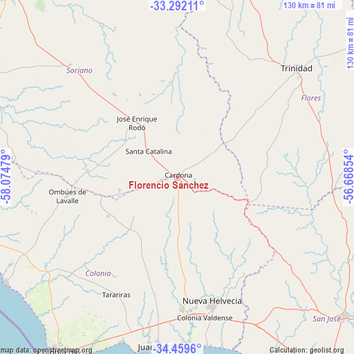
Florencio Sánchez GPS coordinates[2]
33° 52' 40.26" South, 57° 22' 17.976" West
| Map corner | latitude | longitude |
|---|---|---|
| Upper-left | -33.29211°, | -58.07479° |
| Center: | -33.87785°, | -57.37166° |
| Lower-right: | -34.4596°, | -56.66854° |
| Map W x H: | 129.8×129.8 km | = 80.7×80.7mi |
| max Lat: | -30.25966° ⇑47.5% North |
| Florencio Sánchez: | -33.87785° |
| min Lat: | ⇓52.5% South -34.94747° |
| min Long | Florencio Sánc | max Long |
| -58.41176° | -57.37166° | -53.38583° |
| W 22.1%⇐ | ⇒77.9% E |
Elevation
Elevation of Florencio Sánchez is 177 m = 581 ft, and this is 106.4 m = 349 ft above average elevation for this country.
| Max E: |
294 m = 965 ft | 6.6% |
| Florencio Sánchez | 177 m 581 ft | |
| Avg. | 70.6 m = 232 ft | |
Min E: |
2 m = 7 ft | 93.4% |
See also: Uruguay elevation on elevation.city.
Geographical zone
Florencio Sánchez is located in South temperate zone (between Tropic of Capricorn and the Antarctic Circle). Distance of this Southern Tropic circle is 1160.9 km =721.3 mi to North.| Distance of | km | miles | from Florencio Sánchez |
|---|---|---|---|
| Equator | 3766.9 | 2340.6 | to North |
| Tropic Capricorn | 1160.9 | 721.3 | to North |
| Antarctic Circle | 3634.3 | 2258.2 | to South |
| South Pole | 6240.2 | 3877.5 | to South |


Nearby cities:
15 places around Florencio Sánchez: (largest is in red/bold)
• Cardona
0.8 km =0.5 mi,  13°
13°
• Carmelo
85.3 km =53 mi,  260°
260°
• Colonia del Sacramento
78 km =48.5 mi,  213°
213°
• Dolores
87.2 km =54.2 mi,  296°
296°
• Ecilda Paullier
61.1 km =38 mi,  150°
150°
• José Enrique Rodó
25 km =15.5 mi,  323°
323°
• Juan L. Lacaze
60.6 km =37.7 mi,  187°
187°
• Nueva Helvecia
48.6 km =30.2 mi,  164°
164°
• Ombúes de Lavalle
41 km =25.5 mi, 260°
• Palmitas
57.2 km =35.5 mi, 316°
• Rosario
48.8 km =30.3 mi,  177°
177°
• San José de Mayo
79.3 km =49.3 mi,  130°
130°
• Santa Catalina
14.5 km =9 mi,  311°
311°
• Tarariras
48.7 km =30.3 mi, 207°
• Trinidad
59.3 km =36.8 mi,  47°
47°
Sources, notices
• [Note1] Compared only with cities in Uruguay existing in our database
• [Src1] Map data: © OpenStreetMap contributors (CC-BY-SA)
• [Src2] Other city data from geonames.org with taken over terms of usage.
• [Src3] Geographical zone / Annual Mean Temperature by Robert A. Rohde @ Wikipedia
