Muborak geodata
Muborak (Qashqadaryo) is a populated place; located in Uzbekistan in Asia/Samarkand (GMT+5) time zone. With population of 29,180 people, there are 47 cities with bigger population in this country. Compared to other cities in Uzbekistan, 86.2% of cities are located further ↑North; 73.6% of cities are located further →East and 70.7% of cities have higher elevation than Muborak. Note1


Muborak GPS coordinates[2]
39° 15' 19.008" North, 65° 9' 10.008" East
| Map corner | latitude | longitude |
|---|---|---|
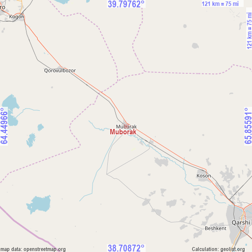
| Upper-left | 39.79762°, | 64.44966° |
| Center: | 39.25528°, | 65.15278° |
| Lower-right: | 38.70872°, | 65.85591° |
| Map W x H: | 121.1×121.1 km | = 75.2×75.2mi |
| max Lat: | 43.77877° ⇑86.2% North |
| Muborak: | 39.25528° |
| min Lat: | ⇓13.8% South 37.22417° |
| min Long | Muborak | max Long |
| 58.84596° | 65.15278° | 72.76177° |
| W 26.4%⇐ | ⇒73.6% E |
Elevation
Elevation of Muborak is 290 m = 951 ft, and this is 143.8 m = 472 ft below average elevation for this country.
| Max E: |
1464 m = 4803 ft | 70.7% |
| Avg. | 433.8 m = 1423 ft | |
| Muborak | 290 m = 951 ft | |
Min E: |
50 m = 164 ft | 29.3% |
See also: Uzbekistan elevation on elevation.city.
Geographical zone
Muborak is located in North temperate zone (between Tropic of Cancer and the Arctic Circle). Distance of this Northern Tropic circle is 1758.9 km =1092.9 mi to South.| Distance of | km | miles | from Muborak |
|---|---|---|---|
| North Pole | 5642.3 | 3506 | to North |
| Arctic Circle | 3036.4 | 1886.7 | to North |
| Tropic Cancer | 1758.9 | 1092.9 | to South |
| Equator | 4364.8 | 2712.2 | to South |


Nearby cities:
15 places around Muborak: (largest is in red/bold)
• Beshkent
64.8 km =40.3 mi,  138°
138°
• Beshkent Shahri
65 km =40.4 mi, 139°
• Bukhara
84.8 km =52.7 mi,  312°
312°
• Kogon
73.2 km =45.5 mi,  315°
315°
• Koson
44.4 km =27.6 mi,  123°
123°
• Koson Shahri
44.4 km =27.6 mi, 121°
• Muborak Shahri
0.4 km =0.2 mi,  50°
50°
• Mug‘lon Shahar
43.6 km =27.1 mi,  149°
149°
• Nishon Tumani
77 km =47.8 mi, 144°
• Qarshi
70.3 km =43.7 mi,  128°
128°
• Qiziltepa Shahri
90 km =55.9 mi,  342°
342°
• Qorovulbozor
41.2 km =25.6 mi, 311°
• Qorovulbozor Shahri
40.2 km =25 mi, 313°
• Yangi Mirishkor
46.2 km =28.7 mi,  166°
166°
• Yangi-Nishon Shahri
82.2 km =51.1 mi, 145°
Sources, notices
• [Note1] Compared only with cities in Uzbekistan existing in our database
• [Src1] Map data: © OpenStreetMap contributors (CC-BY-SA)
• [Src2] Other city data from geonames.org with taken over terms of usage.
• [Src3] Geographical zone / Annual Mean Temperature by Robert A. Rohde @ Wikipedia
