Qiziltepa Shahri geodata
Qiziltepa Shahri (Navoiy) is a seat of a second-order administrative division; located in Uzbekistan in Asia/Samarkand (GMT+5) time zone. In our database, there are 114 cities with bigger population. Compared to other cities in Uzbekistan, 70.7% of cities are located further ↑North; 75.3% of cities are located further →East and 75.9% of cities have higher elevation than Qiziltepa Shahri. Note1


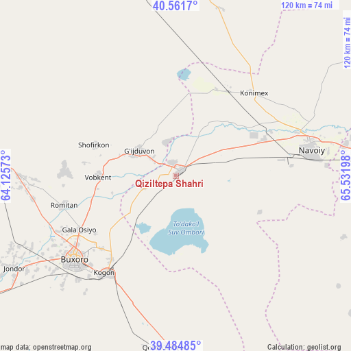
Qiziltepa Shahri GPS coordinates[2]
40° 1' 31.44" North, 64° 49' 43.86" East
| Map corner | latitude | longitude |
|---|---|---|
| Upper-left | 40.5617°, | 64.12573° |
| Center: | 40.0254°, | 64.82885° |
| Lower-right: | 39.48485°, | 65.53198° |
| Map W x H: | 119.7×119.7 km | = 74.4×74.4mi |
| max Lat: | 43.77877° ⇑70.7% North |
| Qiziltepa Shahri: | 40.0254° |
| min Lat: | ⇓29.3% South 37.22417° |
| min Long | Qiziltepa Shahr | max Long |
| 58.84596° | 64.82885° | 72.76177° |
| W 24.7%⇐ | ⇒75.3% E |
Elevation
Elevation of Qiziltepa Shahri is 261 m = 856 ft, and this is 172.8 m = 567 ft below average elevation for this country.
| Max E: |
1464 m = 4803 ft | 75.9% |
| Avg. | 433.8 m = 1423 ft | |
| Qiziltepa Shahri | 261 m = 856 ft | |
Min E: |
50 m = 164 ft | 24.1% |
See also: Uzbekistan elevation on elevation.city.
Geographical zone
Qiziltepa Shahri is located in North temperate zone (between Tropic of Cancer and the Arctic Circle). Distance of this Northern Tropic circle is 1844.5 km =1146.1 mi to South.| Distance of | km | miles | from Qiziltepa Shahri |
|---|---|---|---|
| North Pole | 5556.7 | 3452.8 | to North |
| Arctic Circle | 2950.8 | 1833.5 | to North |
| Tropic Cancer | 1844.5 | 1146.1 | to South |
| Equator | 4450.4 | 2765.3 | to South |


Nearby cities:
15 places around Qiziltepa Shahri: (largest is in red/bold)
• Beshrabot
47.1 km =29.3 mi,  66°
66°
• Bukhara
44.1 km =27.4 mi,  230°
230°
• Galaosiyo
37.4 km =23.2 mi,  240°
240°
• Ghijduwon
14.9 km =9.3 mi,  303°
303°
• Karmana Shahri
48.2 km =30 mi, 74°
• Kogon
41.1 km =25.5 mi,  215°
215°
• Konimex
38.7 km =24 mi,  43°
43°
• Muborak Shahri
89.8 km =55.8 mi,  161°
161°
• Navoiy
47.3 km =29.4 mi,  82°
82°
• Qiziltepa
2 km =1.2 mi,  64°
64°
• Qorovulbozor
58.4 km =36.3 mi,  182°
182°
• Qorovulbozor Shahri
58.1 km =36.1 mi, 181°
• Romiton
39.8 km =24.7 mi,  254°
254°
• Shofirkon
29.8 km =18.5 mi,  290°
290°
• Wobkent
26.7 km =16.6 mi,  271°
271°
Sources, notices
• [Note1] Compared only with cities in Uzbekistan existing in our database
• [Src1] Map data: © OpenStreetMap contributors (CC-BY-SA)
• [Src2] Other city data from geonames.org with taken over terms of usage.
• [Src3] Geographical zone / Annual Mean Temperature by Robert A. Rohde @ Wikipedia
