Bukhara geodata
Bukhara is a seat of a first-order administrative division; located in Uzbekistan in Asia/Samarkand (GMT+5) time zone. With population of 247,644 people, there are 4 cities with bigger population in this country. Compared to other cities in Uzbekistan, 77.6% of cities are located further ↑North; 80.5% of cities are located further →East and 79.3% of cities have higher elevation than Bukhara. Note1


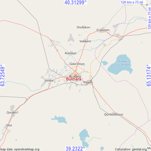
Bukhara GPS coordinates[2]
39° 46' 28.992" North, 64° 25' 42.996" East
| Map corner | latitude | longitude |
|---|---|---|
| Upper-left | 40.31299°, | 63.72549° |
| Center: | 39.77472°, | 64.42861° |
| Lower-right: | 39.2322°, | 65.13174° |
| Map W x H: | 120.2×120.2 km | = 74.7×74.7mi |
| max Lat: | 43.77877° ⇑77.6% North |
| Bukhara: | 39.77472° |
| min Lat: | ⇓22.4% South 37.22417° |
| min Long | Bukhara | max Long |
| 58.84596° | 64.42861° | 72.76177° |
| W 19.5%⇐ | ⇒80.5% E |
Elevation
Elevation of Bukhara is 229 m = 751 ft, and this is 204.8 m = 672 ft below average elevation for this country.
| Max E: |
1464 m = 4803 ft | 79.3% |
| Avg. | 433.8 m = 1423 ft | |
| Bukhara | 229 m = 751 ft | |
Min E: |
50 m = 164 ft | 20.7% |
See also: Bukhara elevation on elevation.city.
Geographical zone
Bukhara is located in North temperate zone (between Tropic of Cancer and the Arctic Circle). Distance of this Northern Tropic circle is 1816.6 km =1128.8 mi to South.| Distance of | km | miles | from Bukhara |
|---|---|---|---|
| North Pole | 5584.5 | 3470 | to North |
| Arctic Circle | 2978.6 | 1850.8 | to North |
| Tropic Cancer | 1816.6 | 1128.8 | to South |
| Equator | 4422.5 | 2748 | to South |


Nearby cities:
15 places around Bukhara: (largest is in red/bold)
• Galaosiyo
9.4 km =5.8 mi,  10°
10°
• Ghijduwon
42.2 km =26.2 mi,  30°
30°
• Karakul’
57.6 km =35.8 mi,  242°
242°
• Kogon
12 km =7.5 mi,  118°
118°
• Konimex
82.6 km =51.3 mi,  47°
47°
• Muborak
84.8 km =52.7 mi,  132°
132°
• Olot
66.9 km =41.6 mi,  233°
233°
• Qiziltepa
46 km =28.6 mi, 51°
• Qiziltepa Shahri
44.1 km =27.4 mi, 50°
• Qorako’l
58 km =36 mi, 238°
• Qorovulbozor
43.7 km =27.2 mi, 134°
• Qorovulbozor Shahri
44.6 km =27.7 mi, 132°
• Romiton
17.7 km =11 mi,  346°
346°
• Shofirkon
38.9 km =24.2 mi, 9°
• Wobkent
29.4 km =18.3 mi, 14°
In other languages:
- In Spanish: Bujará
- In France: Boukhara
- In German: Buchara
- In Russian: Бухара
- In Chinese: 布哈拉
Sources, notices
• [Note1] Compared only with cities in Uzbekistan existing in our database
• [Src1] Map data: © OpenStreetMap contributors (CC-BY-SA)
• [Src2] Other city data from geonames.org with taken over terms of usage.
• [Src3] Geographical zone / Annual Mean Temperature by Robert A. Rohde @ Wikipedia
