Yangi-Nishon Shahri geodata
Yangi-Nishon Shahri (Qashqadaryo) is a seat of a second-order administrative division; located in Uzbekistan in Asia/Samarkand (GMT+5) time zone. In our database, there are 114 cities with bigger population. Compared to other cities in Uzbekistan, 96% of cities are located further ↑North; 65.5% of cities are located further →East and 60.9% of cities have higher elevation than Yangi-Nishon Shahri. Note1


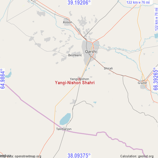
Yangi-Nishon Shahri GPS coordinates[2]
38° 38' 42.036" North, 65° 41' 22.272" East
| Map corner | latitude | longitude |
|---|---|---|
| Upper-left | 39.19206°, | 64.9864° |
| Center: | 38.64501°, | 65.68952° |
| Lower-right: | 38.09375°, | 66.39265° |
| Map W x H: | 122.1×122.1 km | = 75.9×75.9mi |
| max Lat: | 43.77877° ⇑96% North |
| Yangi-Nishon Shahri: | 38.64501° |
| min Lat: | ⇓4% South 37.22417° |
| min Long | Yangi-Nishon Sh | max Long |
| 58.84596° | 65.68952° | 72.76177° |
| W 34.5%⇐ | ⇒65.5% E |
Elevation
Elevation of Yangi-Nishon Shahri is 353 m = 1158 ft, and this is 80.8 m = 265 ft below average elevation for this country.
| Max E: |
1464 m = 4803 ft | 60.9% |
| Avg. | 433.8 m = 1423 ft | |
| Yangi-Nishon Shahri | 353 m = 1158 ft | |
Min E: |
50 m = 164 ft | 39.1% |
See also: Uzbekistan elevation on elevation.city.
Geographical zone
Yangi-Nishon Shahri is located in North temperate zone (between Tropic of Cancer and the Arctic Circle). Distance of this Northern Tropic circle is 1691 km =1050.7 mi to South.| Distance of | km | miles | from Yangi-Nishon Shahri |
|---|---|---|---|
| North Pole | 5710.1 | 3548.1 | to North |
| Arctic Circle | 3104.3 | 1928.9 | to North |
| Tropic Cancer | 1691 | 1050.7 | to South |
| Equator | 4296.9 | 2670 | to South |


Nearby cities:
15 places around Yangi-Nishon Shahri: (largest is in red/bold)
• Beshkent
19.9 km =12.4 mi,  350°
350°
• Beshkent Shahri
18.9 km =11.7 mi, 347°
• Chiroqchi
87.8 km =54.6 mi,  60°
60°
• G‘uzor
48.6 km =30.2 mi,  93°
93°
• G‘uzor Shahri
48.3 km =30 mi, 92°
• Koson
44.6 km =27.7 mi, 348°
• Koson Shahri
45.3 km =28.1 mi, 349°
• Muborak
82.2 km =51.1 mi,  325°
325°
• Muborak Shahri
82.2 km =51.1 mi, 325°
• Mug‘lon Shahar
38.8 km =24.1 mi,  321°
321°
• Nishon Tumani
5.6 km =3.5 mi, 347°
• Qamashi Shahri
70 km =43.5 mi,  73°
73°
• Qarshi
25.5 km =15.8 mi,  19°
19°
• Qorashina
83.2 km =51.7 mi,  113°
113°
• Yangi Mirishkor
42.4 km =26.3 mi,  302°
302°
Sources, notices
• [Note1] Compared only with cities in Uzbekistan existing in our database
• [Src1] Map data: © OpenStreetMap contributors (CC-BY-SA)
• [Src2] Other city data from geonames.org with taken over terms of usage.
• [Src3] Geographical zone / Annual Mean Temperature by Robert A. Rohde @ Wikipedia
