Beshkent geodata
Beshkent (Qashqadaryo) is a populated place; located in Uzbekistan in Asia/Samarkand (GMT+5) time zone. With population of 17,010 people, there are 88 cities with bigger population in this country. Compared to other cities in Uzbekistan, 93.7% of cities are located further ↑North; 67.8% of cities are located further →East and 59.8% of cities have higher elevation than Beshkent. Note1


Beshkent GPS coordinates[2]
38° 49' 17.004" North, 65° 39' 11.016" East
| Map corner | latitude | longitude |
|---|---|---|
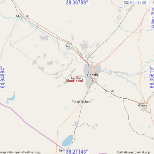
| Upper-left | 39.36709°, | 64.94994° |
| Center: | 38.82139°, | 65.65306° |
| Lower-right: | 38.27148°, | 66.35619° |
| Map W x H: | 121.8×121.8 km | = 75.7×75.7mi |
| max Lat: | 43.77877° ⇑93.7% North |
| Beshkent: | 38.82139° |
| min Lat: | ⇓6.3% South 37.22417° |
| min Long | Beshkent | max Long |
| 58.84596° | 65.65306° | 72.76177° |
| W 32.2%⇐ | ⇒67.8% E |
Elevation
Elevation of Beshkent is 355 m = 1165 ft, and this is 78.8 m = 259 ft below average elevation for this country.
| Max E: |
1464 m = 4803 ft | 59.8% |
| Avg. | 433.8 m = 1423 ft | |
| Beshkent | 355 m = 1165 ft | |
Min E: |
50 m = 164 ft | 40.2% |
See also: Uzbekistan elevation on elevation.city.
Geographical zone
Beshkent is located in North temperate zone (between Tropic of Cancer and the Arctic Circle). Distance of this Northern Tropic circle is 1710.6 km =1062.9 mi to South.| Distance of | km | miles | from Beshkent |
|---|---|---|---|
| North Pole | 5690.5 | 3535.9 | to North |
| Arctic Circle | 3084.6 | 1916.7 | to North |
| Tropic Cancer | 1710.6 | 1062.9 | to South |
| Equator | 4316.5 | 2682.1 | to South |


Nearby cities:
15 places around Beshkent: (largest is in red/bold)
• Beshkent Shahri
1.5 km =0.9 mi,  218°
218°
• Chiroqchi
82.9 km =51.5 mi,  73°
73°
• Chiroqchi Shahri
83.5 km =51.9 mi, 74°
• G‘uzor
56.2 km =34.9 mi,  113°
113°
• G‘uzor Shahri
55.8 km =34.7 mi, 112°
• Koson
24.7 km =15.3 mi,  346°
346°
• Koson Shahri
25.4 km =15.8 mi, 347°
• Muborak
64.8 km =40.3 mi,  318°
318°
• Muborak Shahri
64.7 km =40.2 mi, 318°
• Mug‘lon Shahar
23.5 km =14.6 mi,  297°
297°
• Nishon Tumani
14.3 km =8.9 mi,  172°
172°
• Qamashi Shahri
70.3 km =43.7 mi,  90°
90°
• Qarshi
12.6 km =7.8 mi, 69°
• Yangi Mirishkor
32.7 km =20.3 mi,  275°
275°
• Yangi-Nishon Shahri
19.9 km =12.4 mi, 170°
Sources, notices
• [Note1] Compared only with cities in Uzbekistan existing in our database
• [Src1] Map data: © OpenStreetMap contributors (CC-BY-SA)
• [Src2] Other city data from geonames.org with taken over terms of usage.
• [Src3] Geographical zone / Annual Mean Temperature by Robert A. Rohde @ Wikipedia
