Paxtaobod geodata
Paxtaobod (Andijon) is a seat of a second-order administrative division; located in Uzbekistan in Asia/Tashkent (GMT+5) time zone. In our database, there are 114 cities with bigger population. Compared to other cities in Uzbekistan, 66.1% of cities are located further ↓South; 97.7% of cities are located further ←West and 67.8% of cities have lower elevation than Paxtaobod. Note1


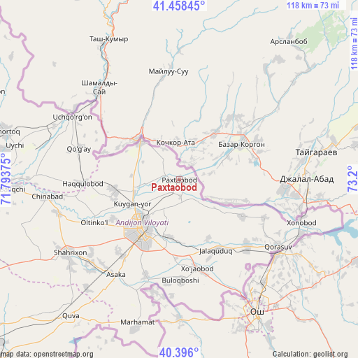
Paxtaobod GPS coordinates[2]
40° 55' 45.696" North, 72° 29' 48.732" East
| Map corner | latitude | longitude |
|---|---|---|
| Upper-left | 41.45845°, | 71.79375° |
| Center: | 40.92936°, | 72.49687° |
| Lower-right: | 40.396°, | 73.2° |
| Map W x H: | 118.1×118.1 km | = 73.4×73.4mi |
| max Lat: | 43.77877° ⇑33.9% North |
| Paxtaobod: | 40.92936° |
| min Lat: | ⇓66.1% South 37.22417° |
| min Long | Paxtaobod | max Long |
| 58.84596° | 72.49687° | 72.76177° |
| W 97.7%⇐ | ⇒2.3% E |
Elevation
Elevation of Paxtaobod is 514 m = 1686 ft, and this is 80.2 m = 263 ft above average elevation for this country.
| Max E: |
1464 m = 4803 ft | 32.2% |
| Paxtaobod | 514 m 1686 ft | |
| Avg. | 433.8 m = 1423 ft | |
Min E: |
50 m = 164 ft | 67.8% |
See also: Uzbekistan elevation on elevation.city.
Geographical zone
Paxtaobod is located in North temperate zone (between Tropic of Cancer and the Arctic Circle). Distance of this Northern Tropic circle is 1945 km =1208.6 mi to South.| Distance of | km | miles | from Paxtaobod |
|---|---|---|---|
| North Pole | 5456.1 | 3390.3 | to North |
| Arctic Circle | 2850.3 | 1771.1 | to North |
| Tropic Cancer | 1945 | 1208.6 | to South |
| Equator | 4550.9 | 2827.8 | to South |


Nearby cities:
15 places around Paxtaobod: (largest is in red/bold)
• Andijon
20.8 km =12.9 mi,  218°
218°
• Asaka
38.7 km =24 mi,  214°
214°
• Buloqboshi
33.4 km =20.8 mi,  179°
179°
• Haqqulobod
32 km =19.9 mi,  267°
267°
• Kuyganyor
18 km =11.2 mi,  242°
242°
• Marhamat
49.6 km =30.8 mi,  196°
196°
• Marhamat
52.2 km =32.4 mi, 197°
• Oltinko‘l
30.7 km =19.1 mi, 242°
• Oxunboboyev
26.3 km =16.3 mi,  152°
152°
• Poytug‘
21.5 km =13.4 mi,  260°
260°
• Qo‘rg‘ontepa
31.3 km =19.4 mi,  134°
134°
• Shahrixon
44.1 km =27.4 mi, 237°
• Uchqŭrghon Shahri
40.6 km =25.2 mi,  300°
300°
• Uychi
51 km =31.7 mi,  289°
289°
• Xo‘jaobod
29.4 km =18.3 mi,  169°
169°
Sources, notices
• [Note1] Compared only with cities in Uzbekistan existing in our database
• [Src1] Map data: © OpenStreetMap contributors (CC-BY-SA)
• [Src2] Other city data from geonames.org with taken over terms of usage.
• [Src3] Geographical zone / Annual Mean Temperature by Robert A. Rohde @ Wikipedia
