Buloqboshi geodata
Buloqboshi (Andijon) is a seat of a second-order administrative division; located in Uzbekistan in Asia/Tashkent (GMT+5) time zone. In our database, there are 114 cities with bigger population. Compared to other cities in Uzbekistan, 52.9% of cities are located further ↓South; 98.3% of cities are located further ←West and 85.6% of cities have lower elevation than Buloqboshi. Note1


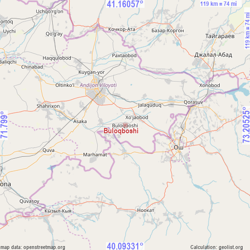
Buloqboshi GPS coordinates[2]
40° 37' 44.652" North, 72° 30' 7.632" East
| Map corner | latitude | longitude |
|---|---|---|
| Upper-left | 41.16057°, | 71.799° |
| Center: | 40.62907°, | 72.50212° |
| Lower-right: | 40.09331°, | 73.20525° |
| Map W x H: | 118.7×118.7 km | = 73.8×73.8mi |
| max Lat: | 43.77877° ⇑47.1% North |
| Buloqboshi: | 40.62907° |
| min Lat: | ⇓52.9% South 37.22417° |
| min Long | Buloqboshi | max Long |
| 58.84596° | 72.50212° | 72.76177° |
| W 98.3%⇐ | ⇒1.7% E |
Elevation
Elevation of Buloqboshi is 649 m = 2129 ft, and this is 215.2 m = 706 ft above average elevation for this country.
| Max E: |
1464 m = 4803 ft | 14.4% |
| Buloqboshi | 649 m 2129 ft | |
| Avg. | 433.8 m = 1423 ft | |
Min E: |
50 m = 164 ft | 85.6% |
See also: Uzbekistan elevation on elevation.city.
Geographical zone
Buloqboshi is located in North temperate zone (between Tropic of Cancer and the Arctic Circle). Distance of this Northern Tropic circle is 1911.6 km =1187.8 mi to South.| Distance of | km | miles | from Buloqboshi |
|---|---|---|---|
| North Pole | 5489.5 | 3411 | to North |
| Arctic Circle | 2883.6 | 1791.8 | to North |
| Tropic Cancer | 1911.6 | 1187.8 | to South |
| Equator | 4517.5 | 2807 | to South |


Nearby cities:
15 places around Buloqboshi: (largest is in red/bold)
• Andijon
21.6 km =13.4 mi,  321°
321°
• Asaka
22.3 km =13.9 mi,  273°
273°
• Haqqulobod
45.6 km =28.3 mi,  314°
314°
• Kuyganyor
30 km =18.6 mi,  326°
326°
• Marhamat
20.5 km =12.7 mi,  226°
226°
• Marhamat
22.9 km =14.2 mi,  223°
223°
• Oltinko‘l
33.7 km =20.9 mi,  304°
304°
• Oxunboboyev
15.6 km =9.7 mi,  49°
49°
• Paxtaobod
33.4 km =20.8 mi,  359°
359°
• Poytug‘
36.9 km =22.9 mi, 324°
• Qo‘rg‘ontepa
24.7 km =15.3 mi,  62°
62°
• Quva
38.2 km =23.7 mi,  251°
251°
• Quvasoy
57.5 km =35.7 mi, 230°
• Shahrixon
38.7 km =24 mi,  284°
284°
• Xo‘jaobod
6.6 km =4.1 mi, 47°
Sources, notices
• [Note1] Compared only with cities in Uzbekistan existing in our database
• [Src1] Map data: © OpenStreetMap contributors (CC-BY-SA)
• [Src2] Other city data from geonames.org with taken over terms of usage.
• [Src3] Geographical zone / Annual Mean Temperature by Robert A. Rohde @ Wikipedia
