Bektemir geodata
Bektemir (Toshkent Shahri) is a populated place; located in Uzbekistan in Asia/Tashkent (GMT+5) time zone. With population of 26,380 people, there are 62 cities with bigger population in this country. Compared to other cities in Uzbekistan, 76.4% of cities are located further ↓South; 61.5% of cities are located further ←West and 51.1% of cities have lower elevation than Bektemir. Note1


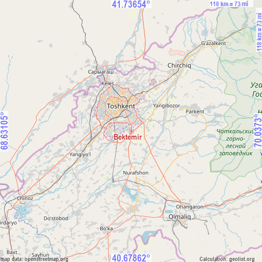
Bektemir GPS coordinates[2]
41° 12' 34.992" North, 69° 20' 3.012" East
| Map corner | latitude | longitude |
|---|---|---|
| Upper-left | 41.73654°, | 68.63105° |
| Center: | 41.20972°, | 69.33417° |
| Lower-right: | 40.67862°, | 70.0373° |
| Map W x H: | 117.6×117.6 km | = 73.1×73.1mi |
| max Lat: | 43.77877° ⇑23.6% North |
| Bektemir: | 41.20972° |
| min Lat: | ⇓76.4% South 37.22417° |
| min Long | Bektemir | max Long |
| 58.84596° | 69.33417° | 72.76177° |
| W 61.5%⇐ | ⇒38.5% E |
Elevation
Elevation of Bektemir is 420 m = 1378 ft, and this is 13.8 m = 45 ft below average elevation for this country.
| Max E: |
1464 m = 4803 ft | 48.9% |
| Avg. | 433.8 m = 1423 ft | |
| Bektemir | 420 m = 1378 ft | |
Min E: |
50 m = 164 ft | 51.1% |
See also: Uzbekistan elevation on elevation.city.
Geographical zone
Bektemir is located in North temperate zone (between Tropic of Cancer and the Arctic Circle). Distance of this Northern Tropic circle is 1976.2 km =1228 mi to South.| Distance of | km | miles | from Bektemir |
|---|---|---|---|
| North Pole | 5425 | 3370.9 | to North |
| Arctic Circle | 2819.1 | 1751.7 | to North |
| Tropic Cancer | 1976.2 | 1228 | to South |
| Equator | 4582.1 | 2847.2 | to South |


Nearby cities:
15 places around Bektemir: (largest is in red/bold)
• Amir Timur
39.2 km =24.4 mi,  237°
237°
• Bo‘ka
45.9 km =28.5 mi,  194°
194°
• Chirchiq
35.5 km =22.1 mi,  35°
35°
• Ohangaron
42.3 km =26.3 mi,  142°
142°
• Olmaliq
46.2 km =28.7 mi,  151°
151°
• Parkent
30.1 km =18.7 mi,  71°
71°
• Piskent
34.8 km =21.6 mi,  177°
177°
• Qibray
22.8 km =14.2 mi,  28°
28°
• Salor
18.5 km =11.5 mi,  12°
12°
• Sŭqoq
38.9 km =24.2 mi,  83°
83°
• Tashkent
11.6 km =7.2 mi,  301°
301°
• Tŭytepa
19.9 km =12.4 mi,  173°
173°
• Yangiyŭl
26.4 km =16.4 mi,  245°
245°
• Zafar
44.2 km =27.5 mi, 235°
• Ŭrtaowul
16 km =9.9 mi,  260°
260°
Sources, notices
• [Note1] Compared only with cities in Uzbekistan existing in our database
• [Src1] Map data: © OpenStreetMap contributors (CC-BY-SA)
• [Src2] Other city data from geonames.org with taken over terms of usage.
• [Src3] Geographical zone / Annual Mean Temperature by Robert A. Rohde @ Wikipedia
