Angren geodata
Angren (Toshkent) is a populated place; located in Uzbekistan in Asia/Tashkent (GMT+5) time zone. With population of 126,957 people, there are 15 cities with bigger population in this country. Compared to other cities in Uzbekistan, 70.1% of cities are located further ↓South; 69.5% of cities are located further ←West and 95.4% of cities have lower elevation than Angren. Note1


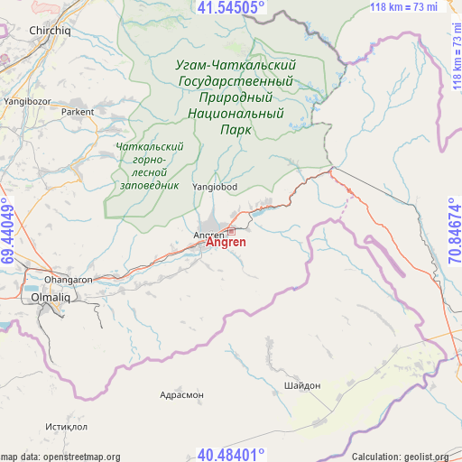
Angren GPS coordinates[2]
41° 1' 0.012" North, 70° 8' 36.996" East
| Map corner | latitude | longitude |
|---|---|---|
| Upper-left | 41.54505°, | 69.44049° |
| Center: | 41.01667°, | 70.14361° |
| Lower-right: | 40.48401°, | 70.84674° |
| Map W x H: | 118×118 km | = 73.3×73.3mi |
| max Lat: | 43.77877° ⇑29.9% North |
| Angren: | 41.01667° |
| min Lat: | ⇓70.1% South 37.22417° |
| min Long | Angren | max Long |
| 58.84596° | 70.14361° | 72.76177° |
| W 69.5%⇐ | ⇒30.5% E |
Elevation
Elevation of Angren is 932 m = 3058 ft, and this is 498.2 m = 1635 ft above average elevation for this country.
| Max E: |
1464 m = 4803 ft | 4.6% |
| Angren | 932 m 3058 ft | |
| Avg. | 433.8 m = 1423 ft | |
Min E: |
50 m = 164 ft | 95.4% |
See also: Angren elevation on elevation.city.
Geographical zone
Angren is located in North temperate zone (between Tropic of Cancer and the Arctic Circle). Distance of this Northern Tropic circle is 1954.7 km =1214.6 mi to South.| Distance of | km | miles | from Angren |
|---|---|---|---|
| North Pole | 5446.4 | 3384.2 | to North |
| Arctic Circle | 2840.5 | 1765 | to North |
| Tropic Cancer | 1954.7 | 1214.6 | to South |
| Equator | 4560.6 | 2833.8 | to South |


Nearby cities:
15 places around Angren: (largest is in red/bold)
• Bektemir
71.1 km =44.2 mi,  287°
287°
• Beshariq
75.6 km =47 mi,  148°
148°
• Chirchiq
68.8 km =42.8 mi,  316°
316°
• G‘azalkent
67.8 km =42.1 mi,  332°
332°
• Iskandar
70.3 km =43.7 mi, 328°
• Kyzyldzhar
62.1 km =38.6 mi,  350°
350°
• Ohangaron
44.2 km =27.5 mi,  253°
253°
• Olmaliq
49.6 km =30.8 mi, 247°
• Parkent
49.8 km =30.9 mi,  308°
308°
• Piskent
67.9 km =42.2 mi,  258°
258°
• Qibray
70.3 km =43.7 mi, 306°
• Salor
75 km =46.6 mi,  301°
301°
• Sŭqoq
38.8 km =24.1 mi, 311°
• Tŭytepa
65.5 km =40.7 mi,  271°
271°
• Yangiobod
12.1 km =7.5 mi,  339°
339°
Sources, notices
• [Note1] Compared only with cities in Uzbekistan existing in our database
• [Src1] Map data: © OpenStreetMap contributors (CC-BY-SA)
• [Src2] Other city data from geonames.org with taken over terms of usage.
• [Src3] Geographical zone / Annual Mean Temperature by Robert A. Rohde @ Wikipedia
