Upata geodata
Upata (Bolívar) is a seat of a second-order administrative division; located in Venezuela in America/Caracas (GMT-4) time zone. With population of 53,685 people, there are 70 cities with bigger population in this country. Compared to other cities in Venezuela, 86.8% of cities are located further ↑North; 96.9% of cities are located further ←West and 65.6% of cities have lower elevation than Upata. Note1


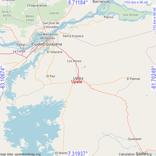
Upata GPS coordinates[2]
8° 0' 58.32" North, 62° 24' 20.196" West
| Map corner | latitude | longitude |
|---|---|---|
| Upper-left | 8.71184°, | -63.10874° |
| Center: | 8.0162°, | -62.40561° |
| Lower-right: | 7.31937°, | -61.70249° |
| Map W x H: | 154.8×154.8 km | = 96.2×96.2mi |
| max Lat: | 11.94788° ⇑86.8% North |
| Upata: | 8.0162° |
| min Lat: | ⇓13.2% South 1.92027° |
| min Long | Upata | max Long |
| -72.55212° | -62.40561° | -60.99778° |
| W 96.9%⇐ | ⇒3.1% E |
Elevation
Elevation of Upata is 322 m = 1056 ft, and this is 58.6 m = 192 ft below average elevation for this country.
| Max E: |
2986 m = 9797 ft | 34.4% |
| Avg. | 380.6 m = 1249 ft | |
| Upata | 322 m = 1056 ft | |
Min E: |
-4 m = -13 ft | 65.6% |
See also: Upata elevation on elevation.city.
Geographical zone
Upata is located in North Torrid zone (between Equator and Tropic of Cancer). Distance of Equator is 891.3 km =553.8 mi to South.| Distance of | km | miles | from Upata |
|---|---|---|---|
| North Pole | 9115.7 | 5664.2 | to North |
| Arctic Circle | 6509.9 | 4045.1 | to North |
| Tropic Cancer | 1714.6 | 1065.4 | to North |
| Equator | 891.3 | 553.8 | to South |


Nearby cities:
15 places around Upata: (largest is in red/bold)
• Barrancas
79.3 km =49.3 mi,  16°
16°
• Ciudad Bolívar
125.6 km =78 mi,  275°
275°
• Ciudad Guayana
45.4 km =28.2 mi,  325°
325°
• Ciudad Piar
118.7 km =73.8 mi,  238°
238°
• Curiapo
167.1 km =103.8 mi,  67°
67°
• El Callao
98 km =60.9 mi,  139°
139°
• El Palmar
54.9 km =34.1 mi,  90°
90°
• El Palmer
57.5 km =35.7 mi, 88°
• Guasipati
82.1 km =51 mi, 136°
• Sierra Imataca
42.3 km =26.3 mi,  352°
352°
• Soledad
128.7 km =80 mi, 277°
• Temblador
113.1 km =70.3 mi, 346°
• Tucupita
122.3 km =76 mi, 18°
• Tumeremo
127.3 km =79.1 mi,  128°
128°
• Uracoa
108.9 km =67.7 mi,  3°
3°
Sources, notices
• [Note1] Compared only with cities in Venezuela existing in our database
• [Src1] Map data: © OpenStreetMap contributors (CC-BY-SA)
• [Src2] Other city data from geonames.org with taken over terms of usage.
• [Src3] Geographical zone / Annual Mean Temperature by Robert A. Rohde @ Wikipedia
