El Palmar geodata
El Palmar (Bolívar) is a seat of a second-order administrative division; located in Venezuela in America/Caracas (GMT-4) time zone. In our database, there are 108 cities with bigger population. Compared to other cities in Venezuela, 87.3% of cities are located further ↑North; 98.5% of cities are located further ←West and 68.2% of cities have lower elevation than El Palmar. Note1


El Palmar GPS coordinates[2]
8° 0' 38.952" North, 61° 54' 25.668" West
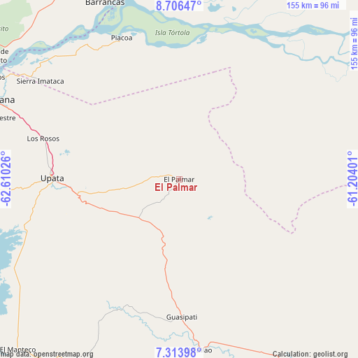
| Map corner | latitude | longitude |
|---|---|---|
| Upper-left | 8.70647°, | -62.61026° |
| Center: | 8.01082°, | -61.90713° |
| Lower-right: | 7.31398°, | -61.20401° |
| Map W x H: | 154.8×154.8 km | = 96.2×96.2mi |
| max Lat: | 11.94788° ⇑87.3% North |
| El Palmar: | 8.01082° |
| min Lat: | ⇓12.7% South 1.92027° |
| min Long | El Palmar | max Long |
| -72.55212° | -61.90713° | -60.99778° |
| W 98.5%⇐ | ⇒1.5% E |
Elevation
Elevation of El Palmar is 387 m = 1270 ft, and this is 6.4 m = 21 ft above average elevation for this country.
| Max E: |
2986 m = 9797 ft | 31.8% |
| El Palmar | 387 m 1270 ft | |
| Avg. | 380.6 m = 1249 ft | |
Min E: |
-4 m = -13 ft | 68.2% |
See also: Venezuela elevation on elevation.city.
Geographical zone
El Palmar is located in North Torrid zone (between Equator and Tropic of Cancer). Distance of Equator is 890.7 km =553.5 mi to South.| Distance of | km | miles | from El Palmar |
|---|---|---|---|
| North Pole | 9116.3 | 5664.6 | to North |
| Arctic Circle | 6510.5 | 4045.4 | to North |
| Tropic Cancer | 1715.2 | 1065.8 | to North |
| Equator | 890.7 | 553.5 | to South |


Nearby cities:
15 places around El Palmar: (largest is in red/bold)
• Barrancas
82.9 km =51.5 mi,  337°
337°
• Ciudad Bolívar
180.3 km =112 mi,  274°
274°
• Ciudad Guayana
89.2 km =55.4 mi,  295°
295°
• Ciudad Piar
167.6 km =104.1 mi,  248°
248°
• Curiapo
118.4 km =73.6 mi,  57°
57°
• El Callao
74.3 km =46.2 mi,  173°
173°
• El Palmer
3.6 km =2.2 mi,  46°
46°
• Guasipati
59.4 km =36.9 mi,  178°
178°
• Sierra Imataca
73.7 km =45.8 mi,  305°
305°
• Soledad
183.3 km =113.9 mi,  275°
275°
• Temblador
137.1 km =85.2 mi,  323°
323°
• Tucupita
117.5 km =73 mi,  352°
352°
• Tumeremo
90.7 km =56.4 mi,  150°
150°
• Upata
54.9 km =34.1 mi, 270°
• Uracoa
119.8 km =74.4 mi, 335°
Sources, notices
• [Note1] Compared only with cities in Venezuela existing in our database
• [Src1] Map data: © OpenStreetMap contributors (CC-BY-SA)
• [Src2] Other city data from geonames.org with taken over terms of usage.
• [Src3] Geographical zone / Annual Mean Temperature by Robert A. Rohde @ Wikipedia
