Río Caribe geodata
Río Caribe (Sucre) is a seat of a second-order administrative division; located in Venezuela in America/Caracas (GMT-4) time zone. In our database, there are 108 cities with bigger population. Compared to other cities in Venezuela, 90.1% of cities are located further ↓South; 94.9% of cities are located further ←West and 50.4% of cities have higher elevation than Río Caribe. Note1


Río Caribe GPS coordinates[2]
10° 41' 51.72" North, 63° 6' 31.356" West
| Map corner | latitude | longitude |
|---|---|---|
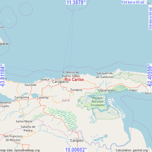
| Upper-left | 11.3878°, | -63.81184° |
| Center: | 10.6977°, | -63.10871° |
| Lower-right: | 10.00602°, | -62.40559° |
| Map W x H: | 153.6×153.6 km | = 95.4×95.4mi |
| max Lat: | 11.94788° ⇑9.9% North |
| Río Caribe: | 10.6977° |
| min Lat: | ⇓90.1% South 1.92027° |
| min Long | Río Caribe | max Long |
| -72.55212° | -63.10871° | -60.99778° |
| W 94.9%⇐ | ⇒5.1% E |
Elevation
Elevation of Río Caribe is 177 m = 581 ft, and this is 203.6 m = 668 ft below average elevation for this country.
| Max E: |
2986 m = 9797 ft | 50.4% |
| Avg. | 380.6 m = 1249 ft | |
| Río Caribe | 177 m = 581 ft | |
Min E: |
-4 m = -13 ft | 49.6% |
See also: Venezuela elevation on elevation.city.
Geographical zone
Río Caribe is located in North Torrid zone (between Equator and Tropic of Cancer). Distance of Equator is 1189.5 km =739.1 mi to South.| Distance of | km | miles | from Río Caribe |
|---|---|---|---|
| North Pole | 8817.6 | 5479 | to North |
| Arctic Circle | 6211.7 | 3859.8 | to North |
| Tropic Cancer | 1416.4 | 880.1 | to North |
| Equator | 1189.5 | 739.1 | to South |


Nearby cities:
15 places around Río Caribe: (largest is in red/bold)
• Cariaco
53.4 km =33.2 mi,  245°
245°
• Caripe
72.3 km =44.9 mi,  216°
216°
• Caripito
65.2 km =40.5 mi,  179°
179°
• Carúpano
16.3 km =10.1 mi,  257°
257°
• Casanay
40 km =24.9 mi,  237°
237°
• El Pilar
17.4 km =10.8 mi,  196°
196°
• Güiria
89.6 km =55.7 mi,  98°
98°
• Irapa
59.3 km =36.8 mi, 103°
• Pampatar
82 km =51 mi,  294°
294°
• Porlamar
88 km =54.7 mi, 289°
• Quiriquire
80.8 km =50.2 mi,  188°
188°
• San Antonio del Golfo
79.6 km =49.5 mi, 249°
• San José de Aerocuar
26.4 km =16.4 mi, 245°
• Tunapuy
13.7 km =8.5 mi, 179°
• Yaguaraparo
34 km =21.1 mi,  114°
114°
Sources, notices
• [Note1] Compared only with cities in Venezuela existing in our database
• [Src1] Map data: © OpenStreetMap contributors (CC-BY-SA)
• [Src2] Other city data from geonames.org with taken over terms of usage.
• [Src3] Geographical zone / Annual Mean Temperature by Robert A. Rohde @ Wikipedia
