Irapa geodata
Irapa (Sucre) is a seat of a second-order administrative division; located in Venezuela in America/Caracas (GMT-4) time zone. In our database, there are 108 cities with bigger population. Compared to other cities in Venezuela, 85.2% of cities are located further ↓South; 96.4% of cities are located further ←West and 94.4% of cities have higher elevation than Irapa. Note1


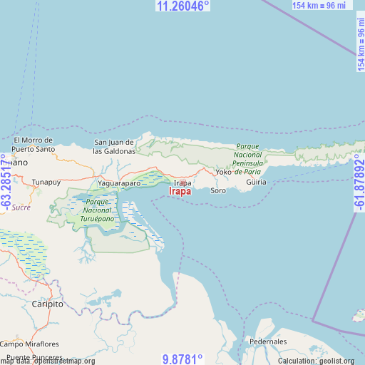
Irapa GPS coordinates[2]
10° 34' 12.216" North, 62° 34' 55.344" West
| Map corner | latitude | longitude |
|---|---|---|
| Upper-left | 11.26046°, | -63.28517° |
| Center: | 10.57006°, | -62.58204° |
| Lower-right: | 9.8781°, | -61.87892° |
| Map W x H: | 153.7×153.7 km | = 95.5×95.5mi |
| max Lat: | 11.94788° ⇑14.8% North |
| Irapa: | 10.57006° |
| min Lat: | ⇓85.2% South 1.92027° |
| min Long | Irapa | max Long |
| -72.55212° | -62.58204° | -60.99778° |
| W 96.4%⇐ | ⇒3.6% E |
Elevation
Elevation of Irapa is 5 m = 16 ft, and this is 375.6 m = 1232 ft below average elevation for this country.
| Max E: |
2986 m = 9797 ft | 94.4% |
| Avg. | 380.6 m = 1249 ft | |
| Irapa | 5 m = 16 ft | |
Min E: |
-4 m = -13 ft | 5.6% |
See also: Venezuela elevation on elevation.city.
Geographical zone
Irapa is located in North Torrid zone (between Equator and Tropic of Cancer). Distance of Equator is 1175.3 km =730.3 mi to South.| Distance of | km | miles | from Irapa |
|---|---|---|---|
| North Pole | 8831.8 | 5487.8 | to North |
| Arctic Circle | 6225.9 | 3868.6 | to North |
| Tropic Cancer | 1430.6 | 888.9 | to North |
| Equator | 1175.3 | 730.3 | to South |


Nearby cities:
15 places around Irapa: (largest is in red/bold)
• Aragua
119.4 km =74.2 mi,  236°
236°
• Cariaco
106.4 km =66.1 mi,  265°
265°
• Caripe
109.7 km =68.2 mi,  246°
246°
• Caripito
76.2 km =47.3 mi,  227°
227°
• Carúpano
74.2 km =46.1 mi,  278°
278°
• Casanay
91.6 km =56.9 mi, 265°
• El Pilar
62.6 km =38.9 mi, 267°
• Güiria
31 km =19.3 mi,  88°
88°
• Maturín
112.8 km =70.1 mi,  215°
215°
• Pedernales
75.8 km =47.1 mi,  151°
151°
• Quiriquire
95.8 km =59.5 mi, 226°
• Río Caribe
59.3 km =36.8 mi, 283°
• San José de Aerocuar
81.7 km =50.8 mi, 272°
• Tunapuy
57.4 km =35.7 mi, 270°
• Yaguaraparo
26.7 km =16.6 mi, 269°
Sources, notices
• [Note1] Compared only with cities in Venezuela existing in our database
• [Src1] Map data: © OpenStreetMap contributors (CC-BY-SA)
• [Src2] Other city data from geonames.org with taken over terms of usage.
• [Src3] Geographical zone / Annual Mean Temperature by Robert A. Rohde @ Wikipedia
