El Junko geodata
El Junko (Vargas) is a seat of a third-order administrative division; located in Venezuela in America/Caracas (GMT-4) time zone. In our database, there are 108 cities with bigger population. Compared to other cities in Venezuela, 80.9% of cities are located further ↓South; 67.4% of cities are located further ←West and 98.5% of cities have lower elevation than El Junko. Note1


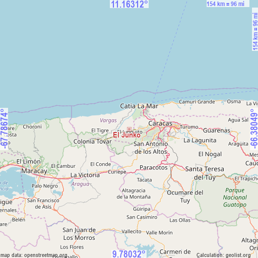
El Junko GPS coordinates[2]
10° 28' 20.964" North, 67° 5' 0.996" West
| Map corner | latitude | longitude |
|---|---|---|
| Upper-left | 11.16312°, | -67.78674° |
| Center: | 10.47249°, | -67.08361° |
| Lower-right: | 9.78032°, | -66.38049° |
| Map W x H: | 153.8×153.8 km | = 95.6×95.6mi |
| max Lat: | 11.94788° ⇑19.1% North |
| El Junko: | 10.47249° |
| min Lat: | ⇓80.9% South 1.92027° |
| min Long | El Junko | max Long |
| -72.55212° | -67.08361° | -60.99778° |
| W 67.4%⇐ | ⇒32.6% E |
Elevation
Elevation of El Junko is 1775 m = 5823 ft, and this is 1394.4 m = 4575 ft above average elevation for this country.
| Max E: |
2986 m = 9797 ft | 1.5% |
| El Junko | 1775 m 5823 ft | |
| Avg. | 380.6 m = 1249 ft | |
Min E: |
-4 m = -13 ft | 98.5% |
See also: Venezuela elevation on elevation.city.
Geographical zone
El Junko is located in North Torrid zone (between Equator and Tropic of Cancer). Distance of Equator is 1164.4 km =723.5 mi to South.| Distance of | km | miles | from El Junko |
|---|---|---|---|
| North Pole | 8842.6 | 5494.5 | to North |
| Arctic Circle | 6236.7 | 3875.3 | to North |
| Tropic Cancer | 1441.5 | 895.7 | to North |
| Equator | 1164.4 | 723.5 | to South |


Nearby cities:
15 places around El Junko: (largest is in red/bold)
• Baruta
23.1 km =14.4 mi,  100°
100°
• Caracas
22.4 km =13.9 mi,  85°
85°
• Caricuao
11.8 km =7.3 mi,  111°
111°
• Carrizal
17.3 km =10.7 mi,  142°
142°
• Catia La Mar
15.8 km =9.8 mi,  20°
20°
• Chacao
25.3 km =15.7 mi,  84°
84°
• El Cafetal
27.8 km =17.3 mi, 91°
• El Hatillo
28.7 km =17.8 mi, 100°
• La Guaira
21.8 km =13.5 mi,  48°
48°
• Las Tejerías
26.2 km =16.3 mi,  202°
202°
• Los Dos Caminos
28 km =17.4 mi, 85°
• Los Teques
14.9 km =9.3 mi,  162°
162°
• Macuto
25.1 km =15.6 mi, 54°
• Maiquetía
19.4 km =12.1 mi, 45°
• San Antonio de Los Altos
17.2 km =10.7 mi,  122°
122°
Sources, notices
• [Note1] Compared only with cities in Venezuela existing in our database
• [Src1] Map data: © OpenStreetMap contributors (CC-BY-SA)
• [Src2] Other city data from geonames.org with taken over terms of usage.
• [Src3] Geographical zone / Annual Mean Temperature by Robert A. Rohde @ Wikipedia
