Thị Trấn Mường Tè geodata
Thị Trấn Mường Tè (Lai Châu) is a seat of a second-order administrative division; located in Vietnam in Asia/Ho_Chi_Minh (GMT+7) time zone. In our database, there are 94 cities with bigger population. Compared to other cities in Vietnam, 94.3% of cities are located further ↓South; 99.8% of cities are located further →East and 85% of cities have lower elevation than Thị Trấn Mường Tè. Note1


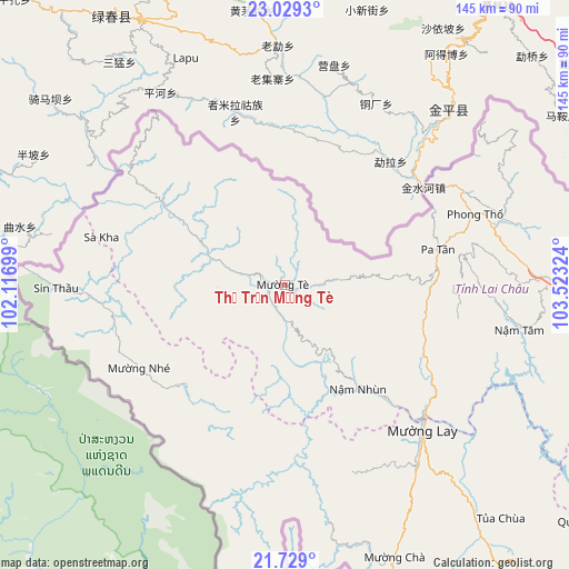
Thị Trấn Mường Tè GPS coordinates[2]
22° 22' 50.412" North, 102° 49' 12.396" East
| Map corner | latitude | longitude |
|---|---|---|
| Upper-left | 23.0293°, | 102.11699° |
| Center: | 22.38067°, | 102.82011° |
| Lower-right: | 21.729°, | 103.52324° |
| Map W x H: | 144.6×144.6 km | = 89.9×89.9mi |
| max Lat: | 23.27841° ⇑5.7% North |
| Thị Trấn Mường Tè: | 22.38067° |
| min Lat: | ⇓94.3% South 8.65724° |
| min Long | Thị Trấn M� | max Long |
| 102.4579° | 102.82011° | 112.72541° |
| W 0.2%⇐ | ⇒99.8% E |
Elevation
Elevation of Thị Trấn Mường Tè is 294 m = 965 ft, and this is 164.5 m = 540 ft above average elevation for this country.
| Max E: |
1592 m = 5223 ft | 15% |
| Thị Trấn Mường Tè | 294 m 965 ft | |
| Avg. | 129.5 m = 425 ft | |
Min E: |
-1 m = -3 ft | 85% |
See also: Vietnam elevation on elevation.city.
Geographical zone
Thị Trấn Mường Tè is located in North Torrid zone (between Equator and Tropic of Cancer). Distance of this Northern Tropic circle is 117.4 km =72.9 mi to North.| Distance of | km | miles | from Thị Trấn Mường Tè |
|---|---|---|---|
| North Pole | 7518.6 | 4671.8 | to North |
| Arctic Circle | 4912.7 | 3052.6 | to North |
| Tropic Cancer | 117.4 | 72.9 | to North |
| Equator | 2488.5 | 1546.3 | to South |


Nearby cities:
15 places around Thị Trấn Mường Tè: (largest is in red/bold)
• Bát Xát
111.4 km =69.2 mi,  80°
80°
• Cát Cát
103.5 km =64.3 mi,  93°
93°
• Dien Bien Phu
112.6 km =70 mi,  169°
169°
• Lai Châu
65.6 km =40.8 mi, 88°
• Lao Chải
108.1 km =67.2 mi, 93°
• Mường Chiên
97.4 km =60.5 mi,  127°
127°
• Mường Chà
74.5 km =46.3 mi,  157°
157°
• Mường Nhé
42.7 km =26.5 mi,  240°
240°
• Mường Ảng
104.3 km =64.8 mi, 156°
• Phong Thổ
52.3 km =32.5 mi,  69°
69°
• Sa Pa
105.4 km =65.5 mi, 92°
• Tam Đường
83.2 km =51.7 mi, 94°
• Thị Trấn Sìn Hồ
42.6 km =26.5 mi, 92°
• Thị Trấn Tuần Giáo
107.6 km =66.9 mi,  144°
144°
• Thị Trấn Tủa Chùa
79.2 km =49.2 mi, 137°
Sources, notices
• [Note1] Compared only with cities in Vietnam existing in our database
• [Src1] Map data: © OpenStreetMap contributors (CC-BY-SA)
• [Src2] Other city data from geonames.org with taken over terms of usage.
• [Src3] Geographical zone / Annual Mean Temperature by Robert A. Rohde @ Wikipedia
