Mường Nhé geodata
Mường Nhé (Ðiện Biên) is a seat of a second-order administrative division; located in Vietnam in Asia/Ho_Chi_Minh (GMT+7) time zone. In our database, there are 94 cities with bigger population. Compared to other cities in Vietnam, 92.2% of cities are located further ↓South; 100% of cities are located further →East and 91.7% of cities have lower elevation than Mường Nhé. Note1


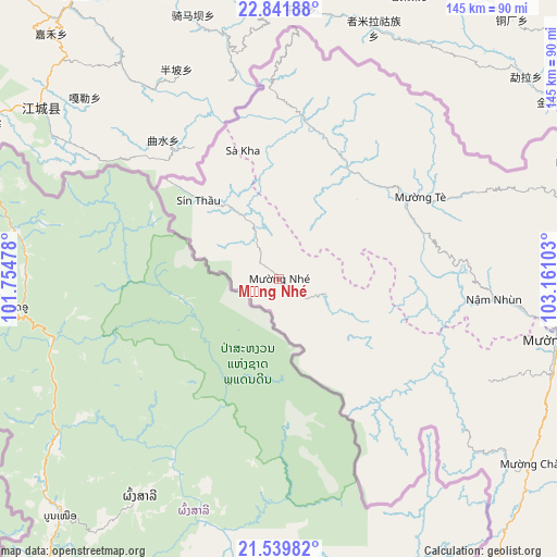
Mường Nhé GPS coordinates[2]
22° 11' 32.496" North, 102° 27' 28.44" East
| Map corner | latitude | longitude |
|---|---|---|
| Upper-left | 22.84188°, | 101.75478° |
| Center: | 22.19236°, | 102.4579° |
| Lower-right: | 21.53982°, | 103.16103° |
| Map W x H: | 144.8×144.8 km | = 90×90mi |
| max Lat: | 23.27841° ⇑7.8% North |
| Mường Nhé: | 22.19236° |
| min Lat: | ⇓92.2% South 8.65724° |
| min Long | Mường Nhé | max Long |
| 102.4579° | 102.4579° | 112.72541° |
| W 0%⇐ | ⇒100% E |
Elevation
Elevation of Mường Nhé is 545 m = 1788 ft, and this is 415.5 m = 1363 ft above average elevation for this country.
| Max E: |
1592 m = 5223 ft | 8.3% |
| Mường Nhé | 545 m 1788 ft | |
| Avg. | 129.5 m = 425 ft | |
Min E: |
-1 m = -3 ft | 91.7% |
See also: Vietnam elevation on elevation.city.
Geographical zone
Mường Nhé is located in North Torrid zone (between Equator and Tropic of Cancer). Distance of this Northern Tropic circle is 138.4 km =86 mi to North.| Distance of | km | miles | from Mường Nhé |
|---|---|---|---|
| North Pole | 7539.5 | 4684.8 | to North |
| Arctic Circle | 4933.6 | 3065.6 | to North |
| Tropic Cancer | 138.4 | 86 | to North |
| Equator | 2467.6 | 1533.3 | to South |


Nearby cities:
15 places around Mường Nhé: (largest is in red/bold)
• Cát Cát
141.5 km =87.9 mi,  83°
83°
• Dien Bien Phu
107 km =66.5 mi,  146°
146°
• Lai Châu
105.4 km =65.5 mi, 77°
• Mường Chiên
120.7 km =75 mi,  108°
108°
• Mường Chà
81.5 km =50.6 mi,  125°
125°
• Mường Ảng
108.7 km =67.5 mi, 133°
• Phong Thổ
94.8 km =58.9 mi,  65°
65°
• Sa Pa
143.6 km =89.2 mi, 83°
• Tam Đường
121 km =75.2 mi, 83°
• Thị Trấn Mường Tè
42.7 km =26.5 mi,  60°
60°
• Thị Trấn Sìn Hồ
82.2 km =51.1 mi, 76°
• Thị Trấn Tuần Giáo
119.9 km =74.5 mi,  123°
123°
• Thị Trấn Tủa Chùa
98.5 km =61.2 mi, 112°
• Thị Trấn Điện Biên
119.6 km =74.3 mi, 150°
• Điện Biên Đông
126.9 km =78.9 mi,  141°
141°
Sources, notices
• [Note1] Compared only with cities in Vietnam existing in our database
• [Src1] Map data: © OpenStreetMap contributors (CC-BY-SA)
• [Src2] Other city data from geonames.org with taken over terms of usage.
• [Src3] Geographical zone / Annual Mean Temperature by Robert A. Rohde @ Wikipedia
