Mường Chiên geodata
Mường Chiên (Sơn La) is a seat of a second-order administrative division; located in Vietnam in Asia/Ho_Chi_Minh (GMT+7) time zone. In our database, there are 94 cities with bigger population. Compared to other cities in Vietnam, 89.1% of cities are located further ↓South; 98% of cities are located further →East and 79.6% of cities have lower elevation than Mường Chiên. Note1


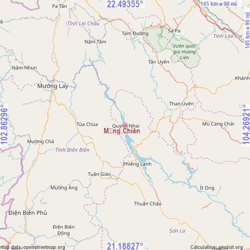
Mường Chiên GPS coordinates[2]
21° 50' 32.64" North, 103° 33' 57.888" East
| Map corner | latitude | longitude |
|---|---|---|
| Upper-left | 22.49355°, | 102.86296° |
| Center: | 21.8424°, | 103.56608° |
| Lower-right: | 21.18827°, | 104.26921° |
| Map W x H: | 145.1×145.1 km | = 90.2×90.2mi |
| max Lat: | 23.27841° ⇑10.9% North |
| Mường Chiên: | 21.8424° |
| min Lat: | ⇓89.1% South 8.65724° |
| min Long | Mường Chiên | max Long |
| 102.4579° | 103.56608° | 112.72541° |
| W 2%⇐ | ⇒98% E |
Elevation
Elevation of Mường Chiên is 160 m = 525 ft, and this is 30.5 m = 100 ft above average elevation for this country.
| Max E: |
1592 m = 5223 ft | 20.4% |
| Mường Chiên | 160 m 525 ft | |
| Avg. | 129.5 m = 425 ft | |
Min E: |
-1 m = -3 ft | 79.6% |
See also: Vietnam elevation on elevation.city.
Geographical zone
Mường Chiên is located in North Torrid zone (between Equator and Tropic of Cancer). Distance of this Northern Tropic circle is 177.3 km =110.2 mi to North.| Distance of | km | miles | from Mường Chiên |
|---|---|---|---|
| North Pole | 7578.4 | 4709 | to North |
| Arctic Circle | 4972.5 | 3089.8 | to North |
| Tropic Cancer | 177.3 | 110.2 | to North |
| Equator | 2428.6 | 1509.1 | to South |


Nearby cities:
15 places around Mường Chiên: (largest is in red/bold)
• Cát Cát
60.5 km =37.6 mi,  26°
26°
• Lai Châu
62.6 km =38.9 mi,  349°
349°
• Lao Chải
61 km =37.9 mi, 30°
• Mù Cang Chải
54 km =33.6 mi,  88°
88°
• Mường Chà
49.2 km =30.6 mi,  259°
259°
• Mường Ảng
50.4 km =31.3 mi,  224°
224°
• Sa Pa
62.3 km =38.7 mi, 27°
• Sơn La
68.1 km =42.3 mi,  147°
147°
• Tam Đường
53.3 km =33.1 mi,  6°
6°
• Than Uyên
34.9 km =21.7 mi,  68°
68°
• Thị Trấn Sìn Hồ
67.6 km =42 mi,  329°
329°
• Thị Trấn Thuận Châu
46.7 km =29 mi,  164°
164°
• Thị Trấn Tuần Giáo
31.8 km =19.8 mi,  207°
207°
• Thị Trấn Tủa Chùa
23.1 km =14.4 mi,  274°
274°
• Ít Ong
59.8 km =37.2 mi,  127°
127°
Sources, notices
• [Note1] Compared only with cities in Vietnam existing in our database
• [Src1] Map data: © OpenStreetMap contributors (CC-BY-SA)
• [Src2] Other city data from geonames.org with taken over terms of usage.
• [Src3] Geographical zone / Annual Mean Temperature by Robert A. Rohde @ Wikipedia
